Global Positioning System Reference
In-Depth Information
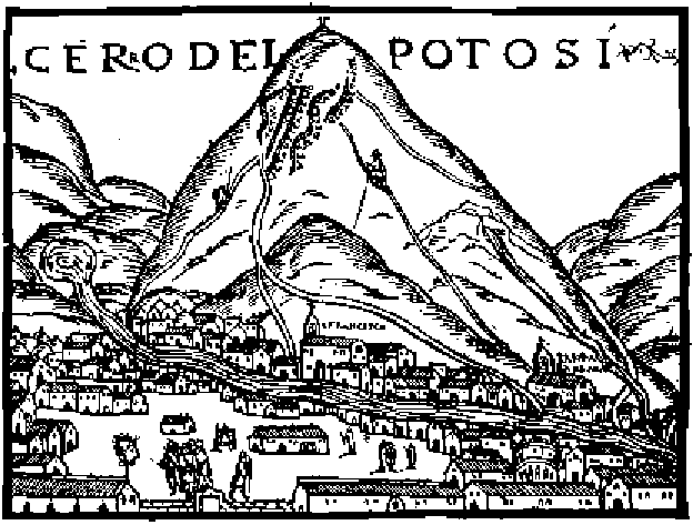
FIGURE 6.10.
An early (1553) view of the Cerra Rico silver mines in Potosi, in modern
Bolivia. This mine was opened in 1545 and generated huge wealth for Spain, which
the ''treasure fleet'' brought back home.
A. Skromnitsky.
suggested that longitude could be established by measuring time di√er-
ences in di√erent parts of the globe.
11
The ideas were there, and people were beginning to get a grip on the
problems of navigation scientifically—mathematically—for the first time
since the ancient Greeks. But the world was not yet ready to accurately
estimate longitude: that was a hard nut to crack, and a practical solution
was not achieved until the eighteenth century. The best that could be done
in the sixteenth and seventeenth centuries was to ''guesstimate'' longitude
by
dead reckoning
, a method for estimating distance traveled. This impor-
tant technique is unpacked in the next section; here, I discuss simpler and
older methods of navigation based on angle estimation.
At the end of the fifteenth century, the Spanish rabbi Abraham Zacuto
11. Frisius was 250 years ahead of his time with this suggestion. The clocks of his day
were far too inaccurate for the purpose, though the idea of using time di√erences to
estimate longitude were sound, and would eventually be adopted.