Global Positioning System Reference
In-Depth Information
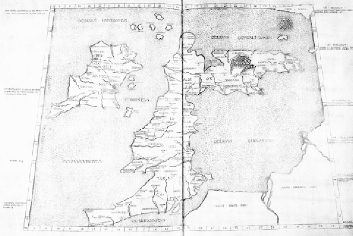
FIGURE 5.3.
A fifteenth-century rendition of Ptolemy's map of Britain.
some writers that Pytheas, after setting out westward from his home port,
had to dodge a Carthaginian blockade of the Pillars of Hercules (the Strait
of Gibraltar).
Once in the Atlantic, Pytheas worked his way up the western coasts of
modern Portugal, Spain, and France to Brittany. From there he crossed the
English Channel to Cornwall to the tin producers. Proceeding northward,
up the west coast of Britain (fig. 5.3), Pytheas observed many details of
British life. He noted that ''for lack of clear sunshine'' Britons threshed
their corn in barns, rather than outside as was the practice in Mediter-
ranean regions. He may have described Stonehenge, even in that day an
ancient monument. He noted that the longest day in Britain contained
''nineteen equinoctial hours''—which is about right for northern Britain.
Britons drank a beverage made from grain and honey (mead). He noted the
high tides of Britain.
Six days' sailing north of Britain, Pytheas discovered an inhabited ''is-
land'' he named Thule. This name passed into folklore of the civilized
of the more developed European cultures. The coins displayed Greek features; in particular,
they were copies of the Macedonian stater.