Geography Reference
In-Depth Information
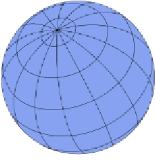
If you look at any geography textbook or world map, you'll see the Earth is divided into
rectangles. These rectangles are formed from the lines of latitude and longitude that make
up our planet's wireframe model. It looks something like the following:
Figure 4: Earth's wireframe model
Each horizontal and vertical line represents one or more whole degrees depending on the
scale factor being used. Minutes are then used to offset the position within that grid square.
When we express a latitude of 50° 25' 32" N, what we are actually saying is 50 degrees
latitude, plus 25 minutes and 32 seconds north into that square, in simple terms. There's a
little more complexity to it if truth be told, but unless you're navigating the high seas or
piloting a commercial airliner, you're probably not going to need to go into that much detail.
The same works for longitude. Everything is expressed as a positive number, so west of the
Prime Meridian is suffixed with a W, and everything to the east is suffixed with an E.
Combining these with the north and south longitude designations divide the planet into four
quadrants of 180 degrees each.
How is this of any relevance to the GIS developer?
If you're looking to retrieve the data from any commercial-grade GPS, particularly those built
into mobile phones, you'll almost always come face to face with the National Marine
Electronics Association and its standards for electronic navigation devices to communicate,
known as the
NMEA 0183
standard. Opening the GPS port on just about any device will
produce a constant stream of data that looks very similar to the following:
$GPGGA,092750.000,5321.5802,N,00630.3372,W,1,8,1.03,61.7,M,55.2,M,,*76
$GPGSA,A,3,10,07,05,02,29,04,08,13,,,,,1.72,1.03,1.38*0A
$GPGSV,3,1,11,10,63,137,17,07,61,098,15,05,59,290,20,08,54,157,30*70
$GPGSV,3,2,11,02,39,223,19,13,28,070,17,26,23,252,,04,14,186,14*79
This data stream is the navigation data emitted by the GPS circuitry in the device in
response to what it's able to receive from the GPS network orbiting the Earth. We'll come
back to this in more detail in a later chapter. For now, I'd like to draw your attention to the
first line of this data, specifically the following entries:
5321.5802,N
and
00630.3372,W