Geography Reference
In-Depth Information
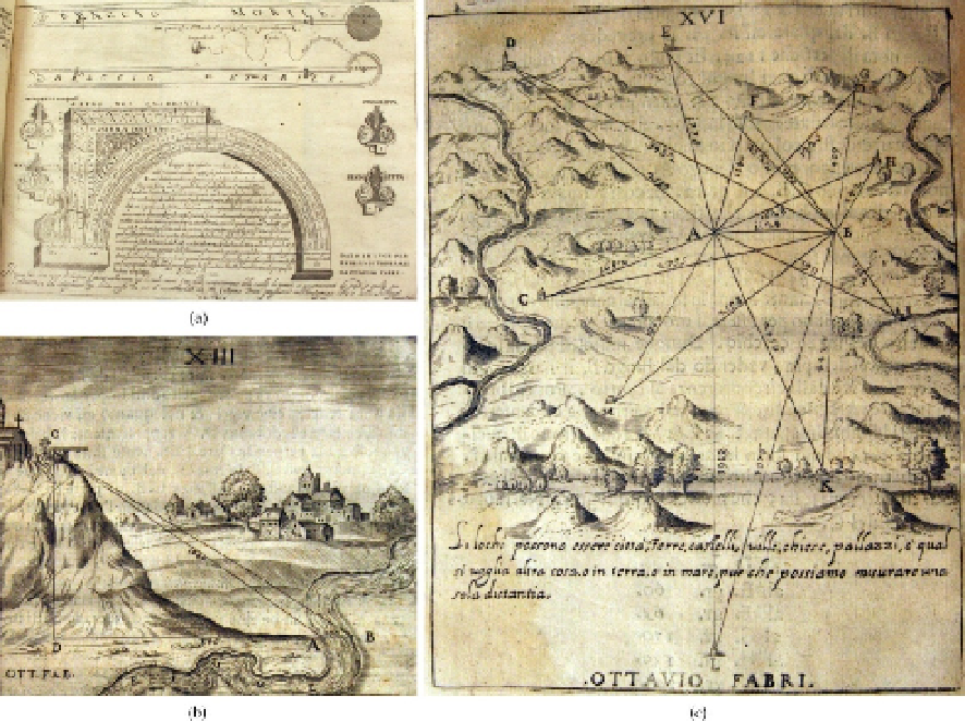
Figure 2.
Images derived from O. Fabri,
L'uso della squadra mobile
(1673 edition, kept in the Engineering
Faculty Library of the University of Bologna): (a) a picture of the
squadra mobile
; (b) measurement of
river widths; (c) an exercise of forward intersection.
3.1. The quantitative approach
3.1.1. Georeferencing
Georeferencing is the technique of inserting a map into a reference system, usually a
modern cartographic one. The process is performed by selecting in the ancient map a proper
number (usually as large as possible) of peculiar points (GCPs, Ground Control Points), still
existing today, and deriving their cartographic coordinates from the present cartography or
a specifically designed survey. In the peculiar case of ancient cartography, the task can be
very difficult or also impossible, because of the remarkable landscape evolution over time
(Benavides & Koster, 2006).
When a sufficient number of points is available, a
one-to-one
correspondence between the
two set of control points lying on two different plane surfaces (i.e. points on the digital
image of the ancient map, expressed in image coordinates, and reference points, expressed
in cartographic coordinates) is established through a “best-fit” process, that finishes with the
calculation of the transformation parameters. The number of involved parameters can varies