Geography Reference
In-Depth Information
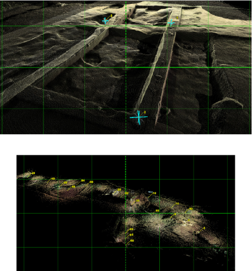
Figure 20.
Bucsani archaeological site - during the archaeological excavations (1 m grid)
Figure 21.
The walled town of Ibida - the archaeological excavations (200 m grid)
The 3D scanning on archaeological sites applies not only to the excavation area but to the
location and tracking of finds as well. The most remarkable results were achieved in the
field of architectural reconstruction of the built space. The Romanian territory conceals a
veritable archaeological treasure, with several hundreds of major sites. In spite of this
richness, most of the excavation projects are still at the level of intention or slow startup.
In a first phase, we carried out the measurements required to outline the features of a tell
(ex: Tangaru) (Figure 22). To delineate the excavation stages and to accurately locate the
finds, several successive scans are carried out on the site, as is the case of the sample