Geography Reference
In-Depth Information
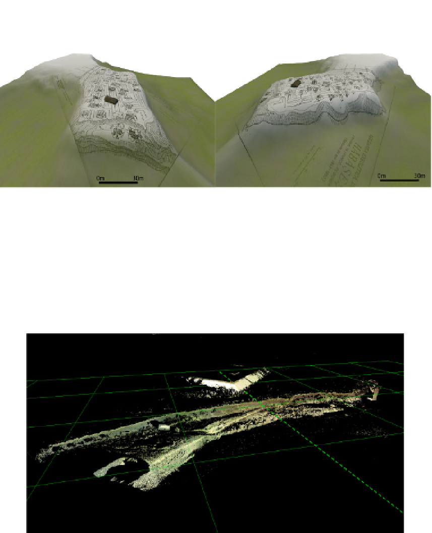
Figure 16.
The prehistoric site of Habasesti following point-cloud processing
The 3D scans are also instrumental in monitoring the riverbanks and in analyzing the
dynamics of the riverine valleys and channels (Figure 17). The most useful measurements
include the lateral erosion, especially at flood times, as well as the accumulation processes
along the riverbed and at river-mouths. In the latter case, the measurements should be taken at
much shorter intervals, as the accumulation and erosion processes can affect the navigation. It
is recommended that the measurements be carried out after each flash-flood. In this case, the
riverbank and riverbed processes can be successfully monitored, especially the thalveg ones.
Figure 17.
The channel of Trotus river at Onesti (30 m grid)
The steep riverbaks are easier to monitor, particularly in the case of highly friable
subbasements (Figure 18, 19). The spasmodic character of rivers in the Moldavian Plateau
bestows a high level of dynamicity to their channels. The solid alluvia of the eastern
Romanian rivers are volumetrically high, while the geomorphologic processes result in
bank-collapse and large accumulations. The use of a large palette of colours in process-