Geography Reference
In-Depth Information
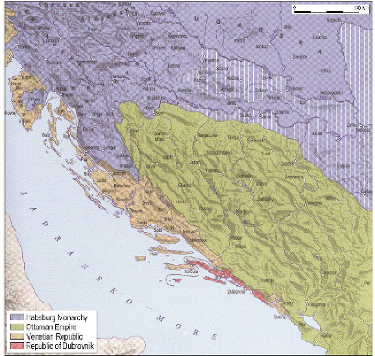
Ottoman Empire and Venetian Republic (Figure1). Borders were, consequently, significantly
influential in political, social, cultural, and demographic sense.
Figure 1.
Croatia and triple border, 18
th
century, [22]
In the history of mapping the Croatian territory, the Early Modern Period was directly
connected with military operations i.e. the process of Ottoman retreat. This is the period
when cartography developed into so-called “military cartography”, practiced in military
institutions. Thus, military engineers were mainly the creators of new maps. However, the
cartographers were rarely independent decision makers, free of financial, military or
political constraints. The context of the cartographer, as Harley has pointed out [8], also
included personal skills and the cartographer as a person living in a particular society and in
particular political circumstances. Accordingly, map could and often did represent an image
with multiple layers of meanings and perceptions and, but also, emphasized features of
strategic importance of the state or empire, i.e. exercising the external and internal power of
cartography [9].
Triple border conditioned a true multicultural surrounding. Croatian territory was a
“meeting point” of Western and Eastern world, Christianity and Islam as well as maritime
and continental traditions. Frequent changes of borderlines were followed by population