Geography Reference
In-Depth Information
Thus, photogrammetry, angle and distance measuring with distance meters and GPS, or
total stations, become useful tools with the adequate standalone or plugin software. Free
software as Angle Meter, Distance Meter and GeoDistance provide easy to use tools to
collect all these datasets [6].
Afterwards digital maps and plans can be drawn with free vector graphics editing programs
as AutoCAD or Inkscape, which can easily integrate the measures and georeferences that
were previously collected.
Depending on the type of heritage and the working scale, 2D and 3D designs as well as
landscape drawings, can be produced in order to show their main characteristics and
features with the required precision.
There are free specific tools for cartography and landscape as Cross GL Draw and Terragen.
The first one is a general purpose 2D raster and vector graphics library. As a full featured
vector graphics editor, it covers a wide range of utilization domains as business graphics, web
graphics, DTP, cartography, printing, user interface graphics, serverside rendering, and many
more. It is a useful tool to draw digital cartography and available for Windows platforms.
Terragen is a powerful solution for rendering and animating realistic landscapes and natural
environments. It is useful in researches on landscape as a cultural heritage, and works both
on Mac OS and Windows operating systems. Ancient maps are useful tools to study the
historical features at a territorial scale. They provide interesting information about the
history of the territory and the landscape, as they depict their main features, their topologic
relationships, and the toponimy [7].
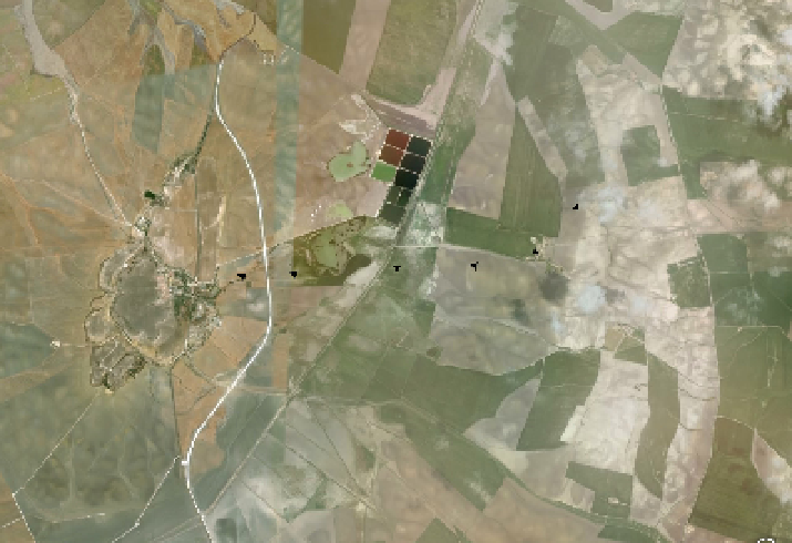
Figure 3.
The
Via Augusta
near the Roman colony of
Hasta Regia
, Cádiz. Hypothetical reconstruction by
means of aerial photographs (Task Group's Partner:
Cultural Heritage and sustainable architecture
Research
Team
, University of Alcalá, Spain).