Geography Reference
In-Depth Information
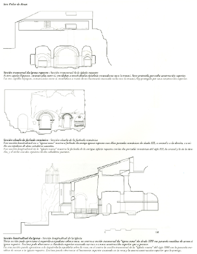
On top: Cross section of the rock church. The three hipogean chancels, which are connected, ventilated through a
skylight dug in the rock (broken lines) that nowadays is protected by an upper building.
Centre: Cross-elevation of the Romanesque façade. This longitudinal section omitting the 'new church', shows the old
rock church with its two 12
th
century Romanesque façades -the central and the right ones-, and the niche with the
tombs of the two recumbent knights.
Below: Longitudinal section of the church. It depicts the bellfry on the rock at the right side; in the middle, the cross
section of the 13
th
century 'new church' can be seen, with the metallic footbridge that leads to the rock church. The old
skylight is placed over the rock church, currently protected with a modern upper structure.
(b)
Figure 1.
a) Combined techniques in use for subterranean heritage mapping. San Pedro de Rocas,
Esgos, Spain (Task Group's Partner:
GIRAP Research Team
, University of La Coruña, Spain).
b) Combined techniques in use for subterranean heritage mapping. San Pedro de Rocas, Esgos, Spain
(Task Group's Partner:
GIRAP Research Team
, University of La Coruña, Spain).