Geography Reference
In-Depth Information
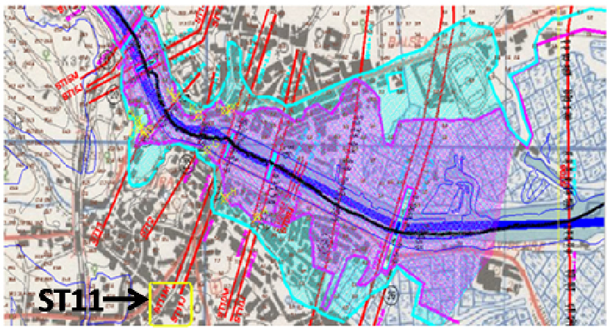
Figure 10.
Flood delimitation for the Tavira urban area. Blue and magenta areas represent, respectively,
the 10- and 100-years return period.
4.5. Conclusions
This application shows an example of how GIS-based soil data may be used as an input for
flood-modelling purposes. In this example HEC-HMS (hydrological model) and HEC-RAS
(hydraulic model) were used to obtain maximum flood levels for 10- and 100-years return
periods.
5. General conclusions
This work aimed to illustrate how GIS-based models can be used as tools for environmental
studies through three case studies in the south of mainland Portugal. The first dealt with the
problem of geo-form classification in the Ria Formosa estuary. The second focused on using
DEM/DTM-based climate models to obtain and analyze isohyetal maps and to identify
rainfall distribution influence on water erosion at the Serra de Grândola. In the third
application, GIS-based models were used to determine hydrological regional parameters for
urban flood mapping purposes (this last application focused in the Séqua/Gilão River and
the city of Tavira). The applications allowed demonstrating the versatility and usefulness of
GIS-based models when used to solve environmental issues.
Author details
Jorge M. G. P. Isidoro
IMAR - Marine and Environmental Research Centre, Department of Civil Engineering,
University of Algarve, Campus da Penha, Faro, Portugal