Geography Reference
In-Depth Information
sign. Stereo imagery allows for multiple views of the same object with 3D capabilities
and the ability to recreate image views where the original cameras never took a picture;
GPSVision™ specified absolute accuracy for terrestrial data positions is
one meter or
less
depending on the distance bewtween the feature to be extracted and the camera
lens. Depending on the image spacing this accuracy can be increased. The GPSVision™
system was designed to deliver sub-meter RMS positions when visible features are
within the camera field of view of both image pairs and
no farther than 30 meters
in
front of the camera lenses;
From a photogrammetric perspective, GPSVision™ is a fix-based stereovision system
with known position and attitude provided by the GPS/INS component. Just as a
person uses two eyes to determine the distance of an object, every infrastructure feature
that is “seen” by the cameras can be triangulated into a three-dimensional coordinate
and then transferred into a global coordinate system (e.g., latitude, longitude, height);
GPSVision™ Feature Extraction software is executable on Microsoft Windows
operating systems. It is driven by an external rule base and is language neutral. The
user interacts with the software by pointing at features of interest seen in the stereo
image pairs with the mouse or stylus. Then, the software triangulates the relative
position of the selected feature and transfers it into the global coordinate system and
positioned to within one meter or less of their actual location;
From an application perspective, the GPSVision™ system is used to collect digital
images along highways, state roads, residential streets, alleys, and railroads while
traveling at posted speed limits. These geo-referenced digital images are used for video
log applications but most importantly, the software is used to position visible physical
features, such as poles, curb lines, traffic signs, manholes, pedestals and building
locations. In addition, the GPS/INS positioning component creates base maps of the
route network for Geographic Information Systems (GIS) base map and Computer
Aided Drafting and Design (CADD) applications.
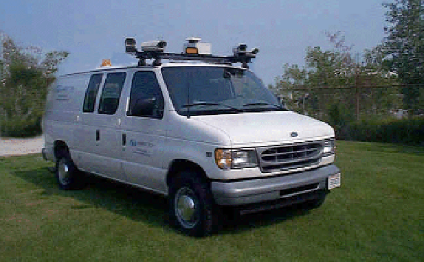
Figure 5.
GPSVision™ - with four video cameras achieved by the “LAMBDA TECH
INTERNATIONAL” Company (USA) for objectives that are closed to the road arteries