Geography Reference
In-Depth Information
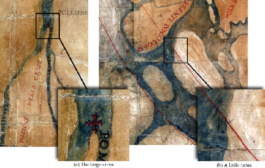
works. A question remains open: were those landmarks the only ones existing or are they
simply a selected set?
Figure 9.
Signs of unclear value (
lost landmarks
) drawn in F map: a large cross at the diffluence point of
two river branches, and a small cross lying on a red double curvilinear track.
4.6. Preparing/correcting/updating drawings
In each map, former drawings of topographical elements can be observed at various places.
They represent details of riverbeds or local ways and were probably drawn as a first
approximation of topographic elements. In the last definitive drawing, they appear
corrected in their shape and/or location (Figure 10).
It may be believed that they represent the first attempt at defining the topographic design in
those parts of the map derived from previous cartographic documents (as stated in the
cartouche of F and L maps, see Paragraph 4.1). In some other cases, these kinds of correction
probably referred to real environmental changes developed over time, as in the case of the
minor branches of the
Scirocco Po
branch near
Mea
place (e.g. in P map, see Figure 10a).
It is difficult to conceal that these features represent an interpretative problem, as they
suggest a high approximation degree in the drafting of the topographic details.
4.7. Additional iconography
In F map a very particular detail consists in a number of appliqués showing ancient vessels
(Figure 11a). It was possible to notice such a detail only thanks to a direct consultation of the