Geoscience Reference
In-Depth Information
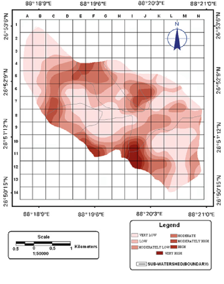
Fig. 7.6 Weighted road contributing area map
0.25 and 0.15 for very high and high landslide susceptibility zones of the watershed
depicts the higher intensity of landslide activities compared to other landslide
susceptibility zones. Here, frequency study shows that more than 19.58 % area is
attributed with high to very high landslide probability, around 48.8 % with mod-
erate landslide probability and remaining area with low landslide probability
(Table
7.6
). In landslide susceptibility classes of high and very high, the
'
values are 2.41 and 3.39 that indicate greater chances of landslide probability. The
determined landslide density and frequency ratio reveals that the areas with high
'
FR
Search WWH ::

Custom Search