Geoscience Reference
In-Depth Information
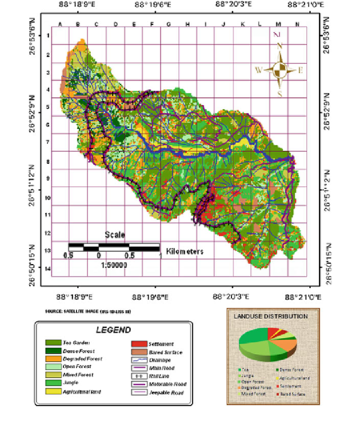
Fig. 4.2 Land use and land cover map of the Shivkhola watershed
Watershed is classi
ed into ten individual land use pattern such as i. Bare Surface,
ii. Agricultural land, iii. Jungle, iv. Roads, v. Settlement, vi. Tea garden, vii. Open
forest, viii. Degraded forest, ix. Mixed forest and x. Dense forest. (Fig.
4.2
). Again,
hydrological soil group wise land use and land cover is attributed (Table
4.1
)to
extract Curve Number following Empirical Curve Number Table under different
hydrological condition for each of the six sub-watersheds which the entire study
area is divided into.
Search WWH ::

Custom Search