Geoscience Reference
In-Depth Information
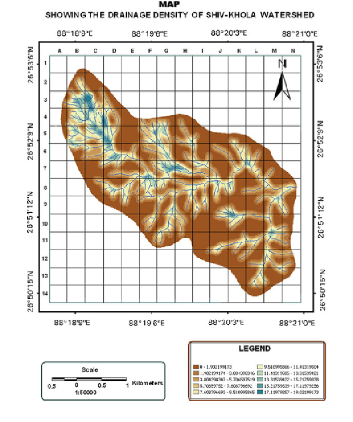
Fig. 3.6 Drainage density (km/km
2
) map of the Shivkhola Watershed
of Upslope Contributing Area which gradually increases away from the water
divide and the maximum of 20.98 km
2
is registered at the lower most portion of
every sub-watershed. The more contributing areas are registered along the main
river which experience maximum flow. Sub-watershed-I and VI are experiencing
maximum upslope contributing area and maximum overland flow in the area of
study. It is to be assumed that the maximum amount of soil erosion is expected in
sub-watershed-I due to maximum overland flow.
Search WWH ::

Custom Search