Geoscience Reference
In-Depth Information
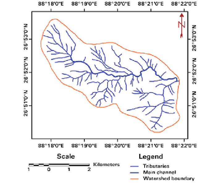
Fig. 3.1 Drainage network of 1972
3.3 Drainage Network Evolution and Landslide
3.3.1 Drainage Network Analysis of 1972
The drainage lines drawn from SOI Topographical map of 1972 reveals less
drainage density and wider watershed areas of overland flow (Fig.
3.1
). The pos-
sibility of head ward extension and further branching indicates potential erosion and
land failure. Only few 1st order
fingertip branches could reach their maximum
length, allowing others to extend rapidly by head ward erosion facilitated by slope
failure. This channelization is also facilitated by the human intervention along the
road as the upslope drainage is concentrated on the road section and flow down
slope as a collected whole. The same is true for the settlement also as the collected
water from roof-top starts flowing down slope with increased energy and concen-
trated erosion is thus facilitated and this may initiate smaller channels and may
increase gradually by either lengthening or widening.
Order wise spatial distribution of drainage network of sub-watersheds in the
Shivkhola shows that maximum no. of 1st order streams (43) are found in sub-
watershed 1and it also covers a large part (4.0 km
2
) within this sub-watershed. Sub-
Search WWH ::

Custom Search