Geology Reference
In-Depth Information
14.3. Remote Sensing Platforms
and Sensors
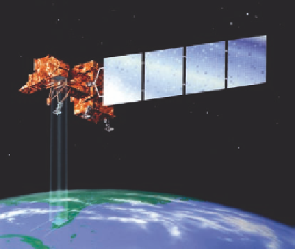
An artist's rendition of the Landsat 7 satel-
lite orbiting the Earth and acquiring image
data.
Image courtesy: NASA.
Overview and Significance
T
he number of past, present, and planned satellite and airborne remote sensing missions is voluminous. The
discussion here is limited to past and present imaging systems (those that acquire images in continuous scan mode)
that provide data at a spatial resolution of 1.1 km or less; that have been used or have a strong potential to be used
for investigating coal-mining areas and coal fires.
Major technological developments in aerial photography took place between 1914 and 1945, commensurate with
World War I and II. In 1960, the first meteorological satellite (TIROS-1) was launched. However, it was only in
1972 with the launch of Landsat-1, the first US-based Earth observing satellite, that remote sensing of the Earth
s
surface received the required impetus. The US military also recognized the potential of imaging in the thermal
infrared (TIR) in the 1950s and invested in developing this technology. In 1978, the National Aeronautics and
Space Administration (NASA) launched the Heat Capacity Mapping Mission (HCMM), where TIR data was
collected day and night at 600m spatial resolution, thereby opening the pathway for the use of TIR technology for a
wide variety of geologic applications.
'
What followed Landsat was a suite of Earth-observing satellite missions that provided data, with higher spatial
resolution, higher spectral resolution, or both. Table 14.3.1 is a list of selected remote sensing platforms and
sensors, data characteristics, and comments on their significance for the coal-mining community.