Graphics Programs Reference
In-Depth Information
.dz { fill: #4EB3D3 }
.ad { fill: #08589E }
.ao { fill: #CCEBC5 }
.ag { fill: #08589E }
.ar { fill: #08589E }
.am { fill: #08589E }
.aw { fill: #08589E }
.au { fill: #08589E }
...
This is standard CSS. The first row, for example, changes the fill color of
all paths with class
.af
to #7BCCC4.
Open
style.css
in your text editor and copy all the contents. Then open
the SVG map and paste the contents at approximately line 135, below the
brackets for
.oceanxx
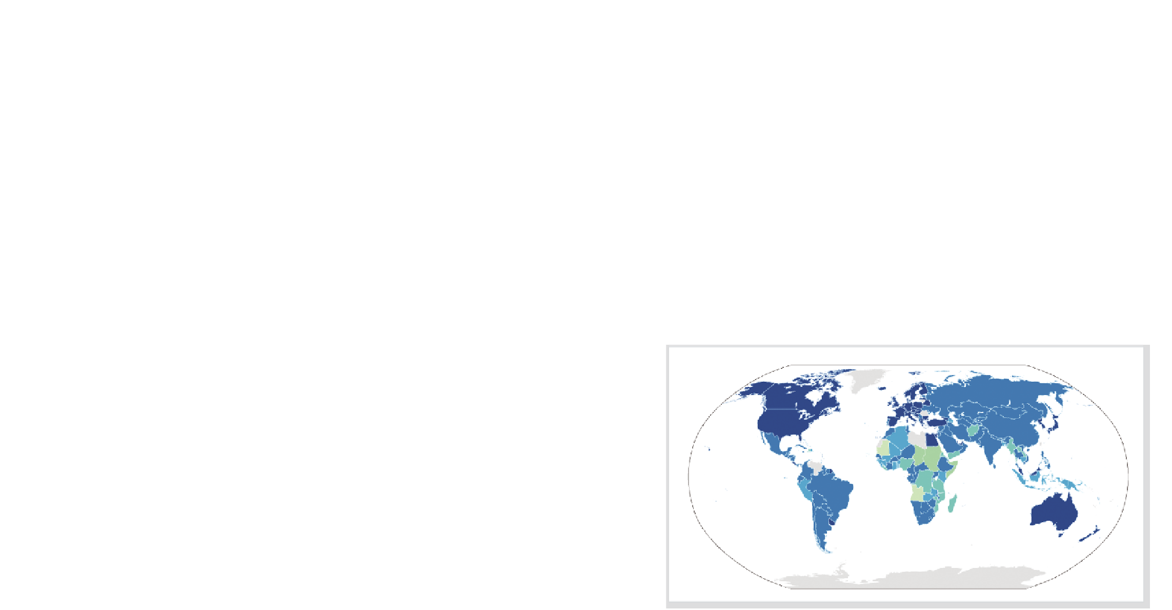
. You just created a choropleth map of the world col-
ored by the percentage of population with access to an improved water
source, as shown in Figure 8-22. The darkest blue indicates 100 percent,
and the lightest shades of green indicate lower percentages. Countries
that are still gray indicate countries where data was not available.
FIGurE 8-22
Choropleth world map showing access to improved water source


Search WWH ::

Custom Search