Geoscience Reference
In-Depth Information
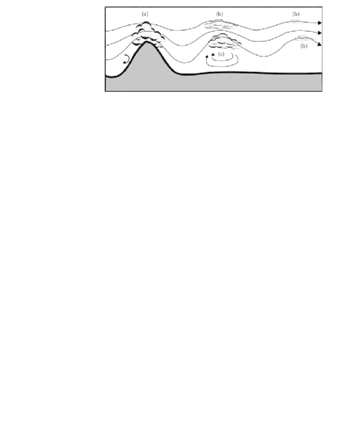
Figure 10.6
Development
of wave clouds over and
downwind of a topographic
barrier showing as (a) the
mountain wave or helm
cloud, as (b) the subsequent
wave clouds, and as (c) the
rotor cloud.
(a)
Warm air
Cold air
(b)
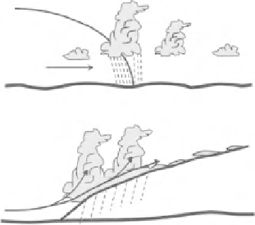
Figure 10.7
Cross-section
of a typical (a) cold front and
(b) warm front. In both
cases the vertical scale is
exaggerated.
Cold air
Warm air
In certain circumstances significant turbulent eddies can develop downwind of
a topographic barrier, and clouds may form at the crests of the waves or at the top
of the large-scale eddies so caused (Fig. 10.6).
Extratropical fronts and cyclones
These weather systems normally result from the interaction of two air masses with
characteristically different temperatures. The interface between two air masses is
called a
cold front
if colder air displaces and moves beneath warm air (Fig. 10.7a)
and a
warm front
if warm air displaces and moves over cold air (Fig. 10.7b). In cold
fronts the interface between the two air masses tends to be steeper than for warm
fronts so the resulting patterns of cloud and precipitation are less extensive in nature.
An approaching cold front is usually associated with increasing wind speed and
reducing pressure, accompanied by increasing cloud that becomes lower and
produces more precipitation as the front passes. If the warm air is unstable,
scattered heavy storms may occur. After passage of the front, the air temperature
falls sharply, pressure rises rapidly, the wind direction changes, and the weather
generally becomes cooler and drier.