Geoscience Reference
In-Depth Information
(2)
Transformation to grid space samples field
around zones of Iatitude and longitude
(1)
Each atmospheric layer held
and moved in spectral space
(3)
Spectral truncation
restricts information
sp
latitude
np
Vertical exchanges
in grid space
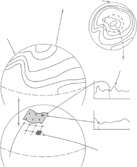
Figure 8.3
Representation of
the atmosphere in GCMs in
spectral coordinates and the
interchange Cartesian
coordinates required to
calculate the physics. (From
Henderson-Sellers and
McGuffie, 1987, published
with permission.)
0
longitude
360
Surface fluxes are
computed in grid space
(4)
Each surface is transformed
into sampled grid space
representation
until the model run reaches some predefined stopping point. Selected calculated
fields are output as the model proceeds that provide the required description of
the evolving atmosphere.
Solving the dynamics
GCMs use two different ways to store state variables. The first is that illustrated in
Fig. 8.1 in which the state variables are stored as individual values of atmospheric
variables for each of the defined atmospheric volume elements as specified by lines
of latitude and longitude using (currently 0.5° to 5°) grid scale and the (currently
5-25 m) vertical height ranges. When this is done, state variables are said to be
stored on a
Cartesian Grid.
The alternative way to store the values of state variables is on a
Spectral Grid
, see
Fig. 8.3. When this is done, instead of storing individual values of atmospheric