Geography Reference
In-Depth Information
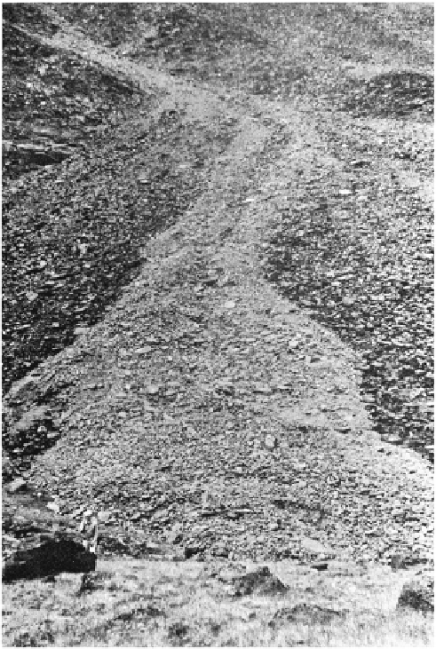
FIGURE 5.11
Mudflow deposits at the base of a rocky slope in the St. Elias Mountains, Yukon Territory.
The lighter colored material in the center represents the most recent flow. Observe the mudflow
channel and levees on the narrow part of the feature. (Photo by L. W. Price.)
Mudflows are so sporadic and unpredictable that very few people have witnessed
them. Saturated debris moves in a rapidly advancing snout of rocks, mud, and water. In
its upper reaches, the mudflow is primarily an agent of erosion, scouring and removing
debris in its path. This process frequently produces a steep-walled, canyon-like channel
up to several meters wide and deep, lined with mud but otherwise free of debris. As the
mudflow progresses downslope, it may slow or stop temporarily when the slope gradi-
ent decreases, or when the snout and other sections become too dry. The stationary
sections serve as dams, pooling water behind them until the mass once again becomes
saturated or the water breaks through the dam and material begins moving again. The
movement of a mudflow, therefore, is often in a series of stops and starts, progressing
downslope. Along the edge of the mudflow channel, particularly in the middle and lower
reaches of the slope, debris is piled on either side like natural levees along a stream.
At the base, the material spreads laterally in lobate fashion to form a debris fan (Fig.
Search WWH ::

Custom Search