Geology Reference
In-Depth Information
2.9.3
Attitude from Map
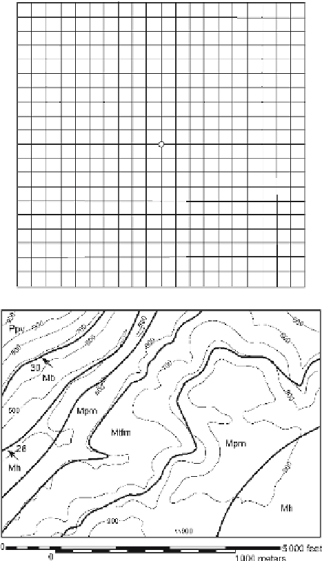
Use the map of the Blount Springs area (Fig. 2.27) to answer the following questions. Find
the attitude of the Mpm in its southeastern outcrop belt using the 3-point method. Draw
structure contours for the Mtfp, Mpm, and Mh on the eastern side of the map. Are the
upper and lower contacts of each unit parallel to each other? Do you think the contacts
are mapped correctly? Determine the attitude of the eastern contact between the Mpm
and the Mtfp by the 3-point method and from the structure contours. Are they the same?
If they are different, discuss which answer is better. What would be the apparent dip of
the Mpm in a north-south roadcut through the northwestern limb of the anticline?
Fig. 2.26.
Map grid for plotting
points in a deviated well
Fig. 2.27.
Geological map of the north-
east corner of the Blount
Springs area, southern Appa-
lachian fold-thrust belt.
Thin
lines
are topographic contours
(elevations in feet).
Thick lines
are geologic contacts.
Arrows
are dip directions;
numbers
give the amount of dip