Geology Reference
In-Depth Information
Fig. 2.5.
3-D oblique view of geologic map of Blount Springs area, from Fig. 2.4. Topography is shown
as shaded relief map, without vertical exaggeration
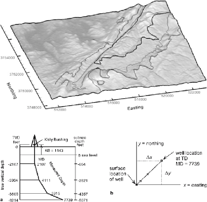
Fig. 2.6.
Location in a deviated well.
a
Vertical section through a deviated well, in the northeast-southwest
direction. Depths in the well are measured downward from the Kelly bushing (
KB
). True vertical depths
(
TVD
) are calculated from the borehole deviation survey.
b
Map view of the deviated well. Locations of
points down hole are given by their distance from the surface location.
TD
total depth;
MD
measured depth
2.2.3.1
Datum
The coordinates of points in a well need to be corrected to a common datum elevation,
normally sea level. The depths should be adjusted so that they are positive above sea
level and negative below. In a vertical well the log depths are converted to a sea-level
datum with the following equation:
SD = KB - MD ,
(2.1)
where SD = subsea depth, KB = elevation of Kelly bushing or other measurement of
surface elevation, MD = measured depth on well log.