Geology Reference
In-Depth Information
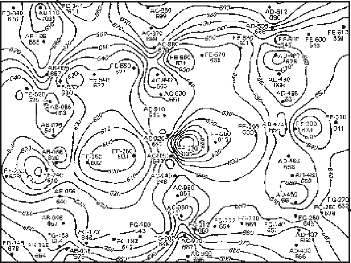
Fig. 10.6.
Cloverleaf structure contour pattern produced by data along three north-south seismic lines
mis-tied to three east-west lines. Control points are indicated by
dots
. Contours are concentrated along
lines of data collection. (Jones et al. 1986)
data set can be internally consistent, but one may have elevations systematically shifted
with respect to the other. Cloverleaf patterns of highs and lows (Fig. 10.6) characterize
this type of problem (Jones et al. 1986; Jones and Krum 1992). Two-dimensional seis-
mic lines in areas of dipping units have the additional problem that the reflections on
lines parallel to strike may be shifted laterally from the surface location of the line,
leading to a similar datum shift between lines that are at right angles to one another
(Oliveros 1989). Mis-ties between reflectors and incorrect stacking velocities can lead
to similar cloverleaf patterns.
10.3
Trend Incompatibilities
The basic principle of trend compatibility is that the trends obtained from different
parts of the total data set, which may include structure contour maps, geological con-
tact locations and bedding attitude measurements, must agree, or a reason for any
discrepancies must be found.
Structure contours are a valuable aid in evaluating the validity of the contact
locations on a geological map. To test the preliminary geologic map of Fig. 10.7a,
find the orientations of the structure contours implied by both the top and bottom