Geology Reference
In-Depth Information
8.8.13
Branching Fault
Map the faults and the top of the Reef Limestone on the map of Fig. 8.60. Where is
the branch line? What is the attitude of the limestone away from the faults? What
is the attitude of the limestone between the faults? What are the attitudes of the
faults?
8.8.14
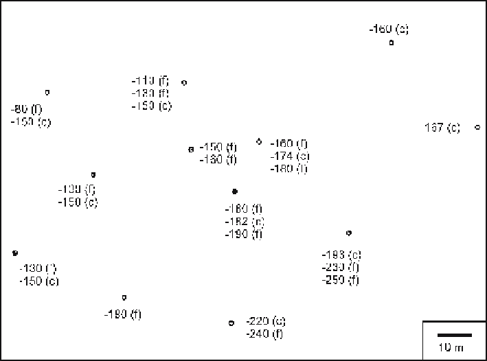
Splay Faults
The water-well map of Fig. 8.61 shows a distinctive clay seam to be absent in some
wells due to faulting. Map the faults and the top of the clay seam. Where is the branch
line? What are the attitudes of the faults? What is the maximum throw and heave on
the clay seam? If the clay seam is a barrier to ground water flow from the surface, where
is this barrier absent? Is a spill of toxic heavy liquid in the southwest corner of the map
area likely to sink below the clay seam? Why or why not? In which direction will a spill
of heavy liquid in the southeast corner of the map migrate?
Fig. 8.61.
Map of the top of a clay seam in water wells drilled into an alluvial aquifer. Elevations below
sea level are negative