Geology Reference
In-Depth Information
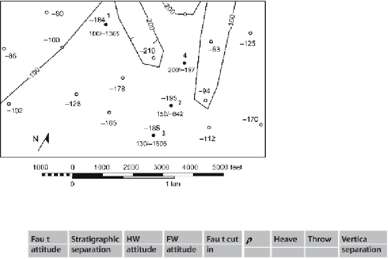
Fig. 7.41.
Map of the southern portion
of the Deerlick Creek coalbed
methane field.
Open circles
are
wells with the elevation of the
top of the Gwin coal cycle (ft).
Solid circles
are wells with fault
cuts; single number is top of
Gwin if present, number pair
is stratigraphic separation/
elevation of fault cut. Structure
contours shown on the top of
the Gwin are tentative. Ele-
vations below sea level are
negative
Table 7.2.
Fault attitude and separation data
Warrior basin is 5 kft long. What is its probable maximum displacement? What is the
displacement range if the fault is a normal fault in the western United States?
7.8.7
Fault Offset
Find the heave, throw, and vertical separation for the faults listed in Table 7.2.
7.8.8
Growth Faults
Determine the expansion indices across both faults in Fig. 7.42. Discuss the growth of
the faults and the relationship of growth to the hydrocarbon occurrence.