Geology Reference
In-Depth Information
3.7.2
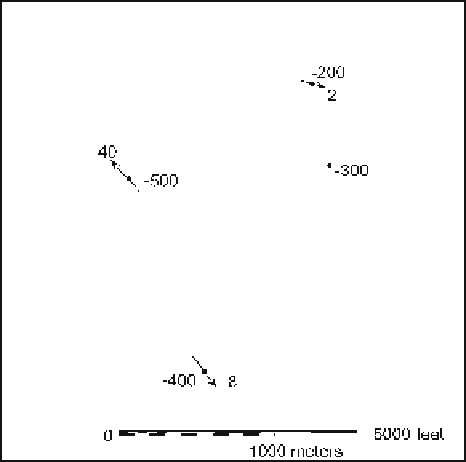
Contour Map from Dip and Elevation
Contour the top of the Tuscaloosa sandstone in Fig. 3.27 using the bedding attitudes to
help generate the contour orientations and spacings. The elevations are in meters.
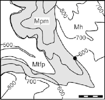
3.7.3
Depth to Contact
Find the elevation of the top of the Mtfp below the dot in Fig. 3.28. The thickness of
the Mpm is 97 ft and the dip is 04°.
Fig. 3.27.
Map of the top of the porous
Tuscaloosa sandstone. Nega-
tive elevations are below sea
level; azimuth of bedding dip
is indicated by
arrows
Fig. 3.28.
Geologic map of the Mill Creek
area. Topographic elevations
are in feet and the scale bar
is 1 000 ft