Geoscience Reference
In-Depth Information
What we do....
Traditional, static/taxonomic,
unit-based constrained
sampling (e.g. riffle-pool for
BMWP).
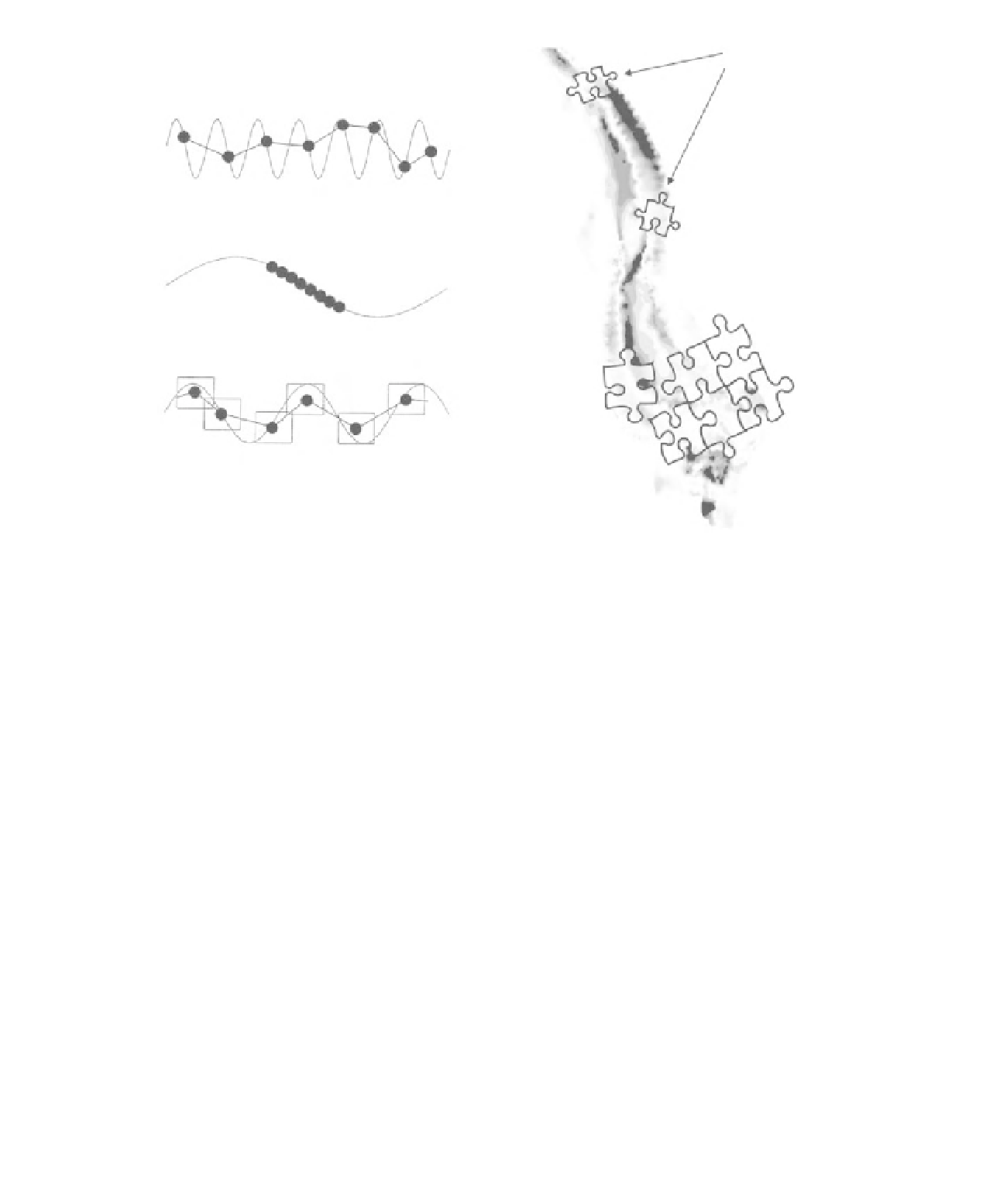
Resolution (spacing) larger than the process scale causing aliasing in
the data. The result is environmental noise.
Extent of survey smaller than the process scale. The result can be an
impression of trend, where in reality there is none.
Spatial or time support too large compared with the process scale. The
result is excessive smoothing of patterns.
What we need....
Predictive and
adaptive
monitoring
(edges and patches,
persistence, resilience,
robustness).
Figure 31.3
How rivers are traditionally sampled, problems with resolution of sampling in time series datasets (after
Bl oschl, 1996), and what is really needed. Predictive flexible and adaptive monitoring focusing on edges and patches
will help to avoid some of the data issues shown (after Bloschl, 1996).
(Dollar, 2004). A major contribution of fluvial
geomorphology is the ability to assess whether
channels can restore themselves if left alone, or
encouraged - through assisted natural recovery - to
achieve a potentially much cheaper way for river
restoration compared with costly engineered
solutions (Brookes and Shields, 1996; Sear
et al
., 2009). Nevertheless, there are still dangers
in drawing conclusions from incomplete or
inappropriate information. For example, rapid
assessment tools developed to characterize river
channels are too generalist at the point of
their application and, despite being based on
'expert knowledge', are often flawed owing to
inadequate local knowledge of river behaviour.
Recent advances of in-channel three dimensional
modelling
approach. For example, in seeking to evaluate site-
specific rather than generalized Habitat Suitability
Indices, the European Aquatic Monitoring Network
compares habitat suitability criteria developed for
individual river reaches, specifying only one flow-
dependent biotope type per reach; the consequence
is that the data are combined from different
sites at different flows and different times of
year (EAMN, 2004). In contrast, others have
used newly available methods such as terrestrial
laser scanning to refine scales of investigation
significantly (Heritage
et al
., 2009; Milan
et al
.,
2010). Both approaches are justified, depending on
the purpose of study; generalized information is
useful for strategic management decisions, while
more
sophisticated
investigation
can
focus
on
offer
a
useful
way
of
filling
these
the
relevant
scale
for
specific
biota
by
using
knowledge gaps (Clifford
et al
., 2006, 2010).
A range of habitat quantification methods has
been developed but these vary widely in their
features
such
as
water
surface
roughness
as
indicators
of
micro-scale
hydraulic
variability.
Effective
characterization
of
hydromorphology