Geoscience Reference
In-Depth Information
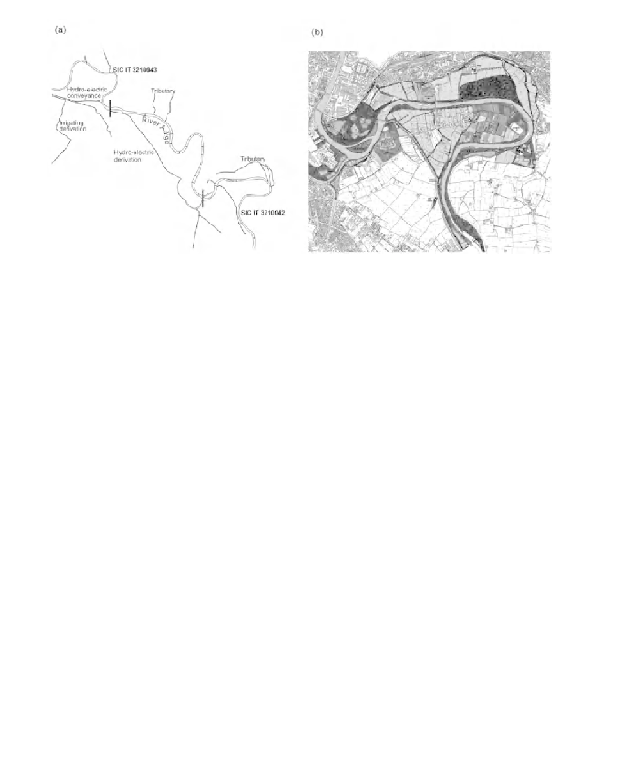
Figure 28.3
(a) Map of the tributaries, irrigation and hydro-electric power channels and the stretches representing
Sites of Community Importance (HD, European Commission, 1992); (b) the river and corridor in the stretch
representing Site of Community Importance IT3210042.
2000
network under the Habitats Directive (Council
of the European Communities, 1992) and other
wildlife habitats in the surrounding hills; (iii) urban
green areas; and (iv) the historic walls of the
Scaligers, the Venetian and Austrian forts, which
include Ancient Roman features (Figure 28.4).
Two research teams applied the IEM approach to
the River Adige, with consultation at each stage in
the process described previously.
riparian habitats to filter nutrients and pollutants
as part of a self-purifying process; and (iii) the
Environmental Landscape Index (ELI), which
expresses the capacity of an area to change without
losing its environmental interest (Braioni
et al
.,
2008a, b).
The WSI, BSI and ELI indices, used in
conjunction with traditional phyto-sociological
analyses of vegetation and measurements of
biological water quality and flow diversity, showed
the close coincidence between high (near-natural
or wild state) quality of the banks and riparian
areas and good environmental-landscape quality
of the river corridor. Notable and priority habitats
designated under the Habitats Directive (Council
of the European Communities, 1992) in these
areas included: (i) riparian and alluvial forests with
white willow (
Salix alba
), alder (
Alnus glutinosa
)
and ash (
Fraxinus excelsior
); (ii) semi-natural
dry grasslands (
Festuco-Brumetalia
) important for
orchids; (iii) muddy river banks with
Polygono-
Bidention
vegetation; (iv) mesophilous lowland
hay meadows; and (v) submerged and floating
vegetation (
Ranunculion fluitantis
and
Callitricho-
Batrachian
) in the river channel (Figure 28.5). In
Ecological and hydrological
assessment
A team comprising biologists, ecologists, botanists,
chemists and hydraulic engineers, collected,
collated and analysed the attributes of the
river and its corridor listed in Table 28.1. This
research covered key ecological, hydrological,
morphological and landscape aspects. Three
indices were used to summarize the resulting
information: (i) the Wild State Index (WSI),
based on the diversity, richness and complexity of
fluvial habitats; (ii) the Buffer Strip Index (BSI),
derived using an assessment of the capacity of