Geoscience Reference
In-Depth Information
(a)
(b)
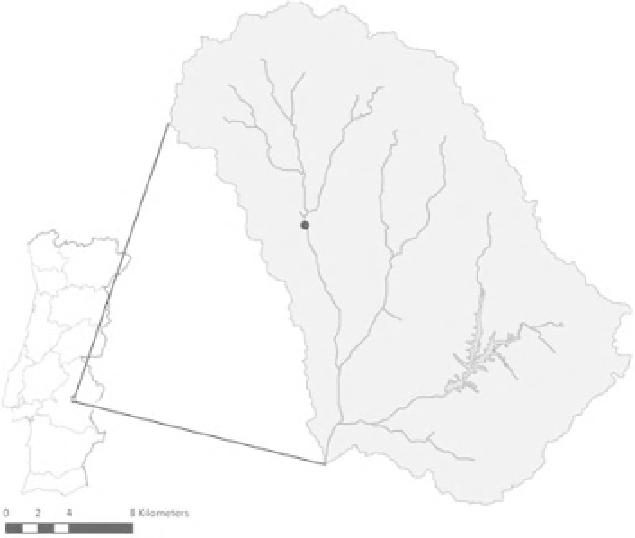
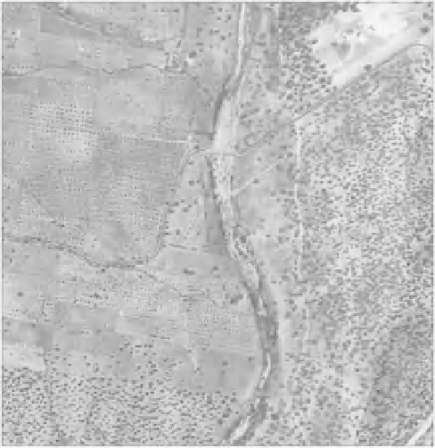
Figure 22.1
a) Map of Portugal, showing the location of the Pardiela catchment (38
◦
38' N, 07
◦
42'W), the
1km
×
1 km study site (black dot) and the Vigia reservoir. b) Aerial photographs of the study site taken in 1958 (left)
and 2005 (right).
discharge in the wet autumn and winter. During
the summer, the headwaters dry out completely
and the middle reaches contract to a series of pools.
The downstream reaches contain water all year
round owing to the presence of a large dam located
in an adjoining tributary and a weir where the
Pardiela joins the Degebe River. Catchment land-
use is dominated by holm oak (
Quercus ilex
ssp.
rotundifolia
), olive groves, vineyards and pasture
land. Riparian vegetation is fragmented and mainly