Geoscience Reference
In-Depth Information
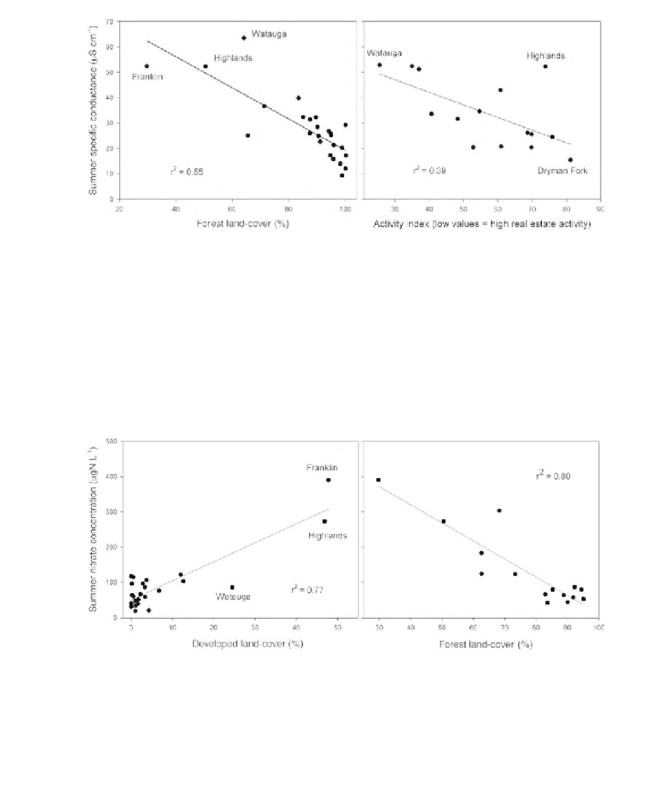
Figure 8.4
Relationships between summer specific conductance and forest land-cover and real estate activity. The left
panel is for the smaller catchments and the right panel is for the larger catchments. Linear regression lines and
coefficient of determination are shown in the figures.
development, much of it in a gated community
established about 20 years ago. In contrast, Jones
Creek is much less developed, and development
follows traditional patterns with agricultural land
and residences in the valleys (Figure 8.8).
Mountainside development was clearly
correlated with land value (Figure 8.9), largely
driven by the presence of Highlands, a town with
a large seasonal population located at over 1250 m
elevation. There was also a good correlation
between nitrate concentration and the extent
of mountainside development with two notable
outliers: Franklin, where 11% of the parcel
area is commercial, and Rabbit Creek, which
is the only catchment with extensive row crop
agriculture.
Figure 8.5
Relationships between summer nitrate concentration and developed and forest land-cover. The left panel is
for the smaller catchments and the right panel is for the larger catchments. Linear regression lines and coefficient of
determination are shown in the figures.