Geoscience Reference
In-Depth Information
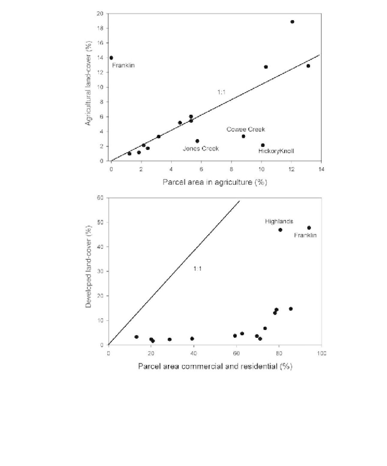
Figure 8.3
Relationships between agricultural land-cover and land-use (parcel area) (upper panel) and between
developed land-cover and commercial and residential land-use (lower panel). Both graphs are for the 15 larger
catchments. The lines in both panels are 1:1 lines.