Graphics Programs Reference
In-Depth Information
Exercise 8.6: Apply Profile view labels
In this exercise, you'll use profile view labels to label the location where Jordan
Court ties in to Emerson Road, including the identification of the ditch area.
▶
If you haven't already
done so, download
and install the files for
Chapter 8 according to
the instructions in the
Introduction.
1.
Open the drawing named
Profile View Labels.dwg
located in the
Chapter 08
class data folder.
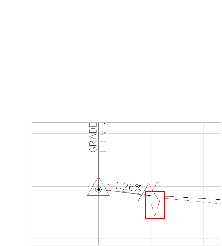
This drawing is zoomed in to the left end of the Jordan Court
FGCL profile. At this location, there is a PVI where the new road ties
to the edge of the existing road. There is also a V shape in the exist-
ing ground profile that shows the existence of a roadside drainage
ditch (see Figure 8.8).
Tie to edge of
existing road
Drainage
ditch
FiGuRE 8.8
The beginning of the Jordan Court FGCL profile, where there is a
tie to the edge of the existing Emerson Road as well as a V-shaped drainage ditch
2.
Click one of the grid lines for the Jordan Court profile view. On the
ribbon, click Add View Labels
➢
Station Elevation.
You must provide the
location in two separate
steps: First you specify
the station (step 4), and
then you specify the
elevation (step 5).
3.
While holding down the Shift key, right-click and select Endpoint
from the context menu.
4.
Click the center of the black-filled circle at the second PVI marker.
▶
5.
Repeat the previous two steps to specify the same point for the
elevation.
A new label appears, but it's overlapping the grade label to the left.