Graphics Programs Reference
In-Depth Information
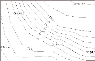
FiGuRE 4.19
Contour labels
17.
Continue placing contour labels until you've evenly distributed labels
throughout the drawing.
18.
Save and close the drawing.
You can view the results of successfully completing this exercise by
opening
Labelling Surfaces - Complete.dwg
.
Now You Know
Now that you have completed this chapter, you understand the role of surfaces in land-development
projects. You can create surfaces from survey data and perfect them by adding breaklines and
boundaries. You can modify surfaces by deleting lines and editing points. You can get answers
and tell stories about surfaces using analysis types such as elevation banding, slope banding, and
slope arrows. Finally, you're able to provide additional information about a surface using several
different types of labels.
Now that you've learned this major step in establishing the existing conditions of your project,
you're ready to begin learning about the tools used to transform your project through design.