Geology Reference
In-Depth Information
a
b
c
d
e
f
g
h
i
j
k
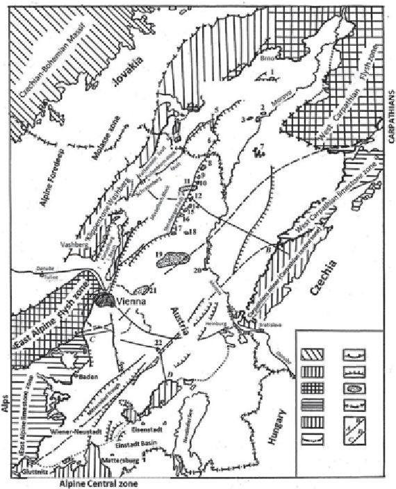
Figure 1.5
The Viennese Basin. Oil and gas field location map.
a.
Crystalline rocks
of the Bohemian Massif;
b.
Washberg clip zone;
c.
Flysh zones;
d.
Limestone zones;
e.
Alpine-Carpathian zone of the Eastern Alps;
f.
Basin boundaries;
g.
Overthrusts;
h.
Normal regional faults;
i.
Gas and oil fields;
j.
Political boundaries;
k.
Proiles.
Fields:
1.
Wazenowizi;
2.
Godenin,
3.
Zhizhkov,
4.
Luzhitsi,
5.
Bilovice,
6.
Breslov,
7.
Gbely,
8.
Mühlberg ,
9.
Sankt-Ulrich,
10.
Win-Zickl,
11.
Houskirchen,
12.
Gesting,
13.
Moustrenk,
14.
Rag,
15.
Zistendorf,
16.
Geiselberg,
17.
Spanberg,
18.
Hohenruppelsdorf,
19.
Matzen,
20.
Zwerndorf,
21.
Aderlkaa,
22.
Enzersdorf.
Local highs in the region are mostly high-amplitude intensely faulted
fault-line structures. They are clearly linear due to association with regional
faults.
In terms of its oil and gas occurrences, the Viennese Basin is a unique
example of the hydrocarbon saturation associated with neotectonic faults