Geology Reference
In-Depth Information
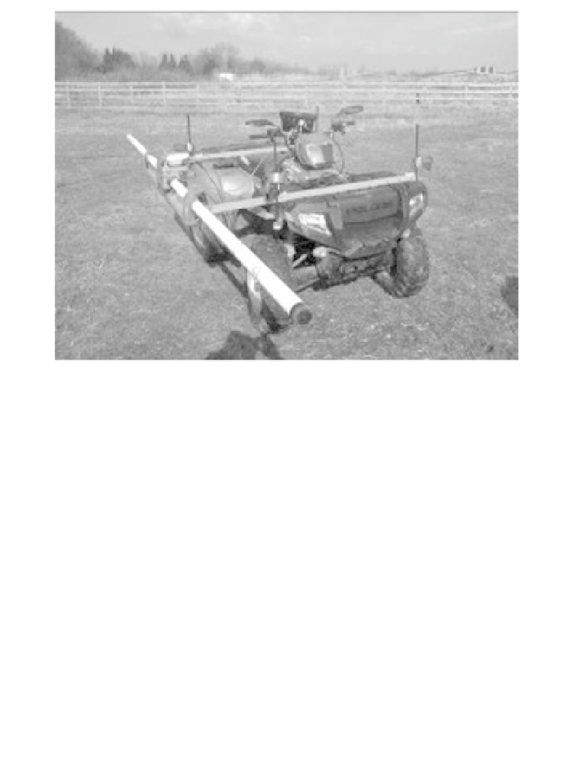
Figure 1.16
Geonics EM-31 mounted on a quad bike. Induced currents
will flow in the vehicle as well as in the ground, but should be reasonably
constant.
1.7.2 Vehicle-mounted systems
The increasing use of vehicle-mounted systems in medium- to large-scale
geophysical surveys is a particularly welcome trend for those who (like
the authors) have been worn down by a lifetime of walking lines carrying
instruments. The system shown in Figure 1.16 is a good example of life
being made very much easier. It was used to record ground conductivity
data to delineate a fault, using a Geonics EM31-Mk2 and a DGPS system
with EGNOS capability (see Section 15.2) to 2 m spatial accuracy, in less
than one-third of the time it would have taken on foot.
Most continuously recording geophysical instruments can be mounted
in this way, achieving significant cost benefits in open areas more than 5
hectares in area, if these are to be covered by lines more than 2 m apart.
The agricultural quad-bike is the vehicle of choice. The main precaution
required is regular checking of satellite coverage, and care must also be
taken to travel at speeds compatible with the station interval needed to map
the target. It is all too tempting to try to squeeze in a few extra lines by
opening the throttle.