Geology Reference
In-Depth Information
d
d
d
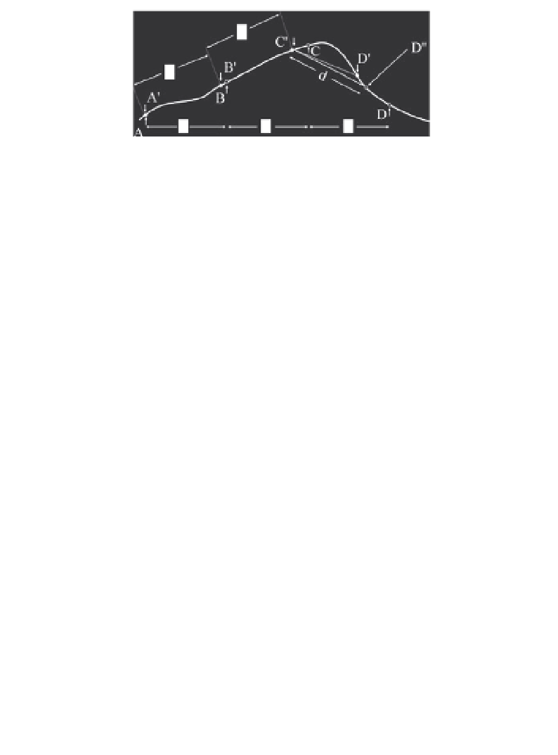
Figure 8.6
Secant chaining and slope chaining. Down arrows and closed
circles show locations of stations separated by intervals of
d
metres mea-
sured along slope. Up arrows and open circles show locations of secant-
chained stations, separated by
d
metres horizontally. Between C and D the
topographic 'wavelength' is less than the station spacing and the straight
line separation of C
from D
is less than the 'along-slope'
d
. The 'correct'
slope position, measured from C
,isatD
.
Thus, for small errors, the percentage error in the in-phase component is
three times the percentage error in distance. Since real anomalies of only a
few percent can be important, separations must be kept very constant.
8.1.6 Surveys on slopes
On sloping ground, the distances between survey pegs may be measured
either horizontally (
secant chaining
) or along slope (Figure 8.6). If along-
slope distances are used in reasonably gentle terrain, coil separations should
be constant, but it is difficult to keep coils co-planar without a clear line of
sight and simpler to hold them horizontal. The field
F
(
p
) along the receiver
axis is then equal to the co-planar field for that separation (
r
in Figure 8.5)
multiplied by (1
−
3sin
2
ϕ
), where
ϕ
is the slope angle (Figure 8.5). The
factor (1
−
3sin
2
ϕ
) is always less than 1 (coils really are maximum-coupled
when co-planar) and the correction multiplier 1
/
(1
ϕ
) becomes
infinite when the slope is 35
◦
because the primary field is then horizontal
(cf. Figure 1.5).
If secant-chaining is used, the distances along slope between coils are
proportional to the secant (
=
1
/
cosine) of the slope angle. For truly co-
planar coils, the ratio of the 'normal' to the 'slope' field is therefore cos
3
−
3sin
2
ϕ
and the correction factor is sec
3
ϕ
. However, as noted, ensuring that the coils
are, in fact, co-planar is not easy, and often they are held horizontal. The
combined correction factor in this case is sec
3
ϕ/
(1
−
3sin
2
ϕ
) (Figure 8.7).
Separations in rugged terrain can differ from their nominal values if
the coil separation is greater than the topographic 'wavelength' (Fig-
ure 8.6). Accurate surveying is essential in such areas and field crews may