Geography Reference
In-Depth Information
70
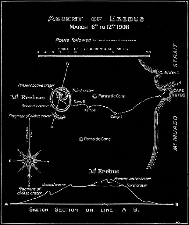
Figure 3.3. David's map of
the ascent route to the cra-
ter of Mount Erebus may
be matched with Fig. 3.2.
The lower two spots on
Fig. 3.2 are Camps II and
III. The uppermost spot,
where the party camped
at the edge of the “Second
Crater,” is not shown on
David's map.
haul an eleven-foot sledge. The advance party would have crampons, one-man sleeping
bags, and the means to backpack with a tent and stove to higher elevations. The support
party, with no crampons and a three-man sleeping bag, was not (in Shackleton's mind)
expected to summit, although he did allow the leaders of the parties the authority to de-
cide on the mountain whether the support party would attempt the crater.
The advance party consisted of David (leader), Mawson, and Mackay (two geologists
and a physician), and the support party, Adams (overall leader), Brocklehurst, and Mar-
shall (a meteorologist, a geologist, and a physician). They set out together on March 5.
Once on the trail, none of the men would be denied. After two days of pulling the sledge
over all manner of ice and snow as well as carrying it over rocks, the parties camped at an
elevation of 5,630 feet at minus 28° F (Camp II, Fig. 3.3). To the man they wanted to creep
to the edge of the volcano and peer into its wheezing maw. By then, they were a team in
the trusses, and Adams gave the nod, even though the support team would be hampered
by its large sleeping bag and at a disadvantage on steeper ice without crampons.
The next day the men deposited the sledge and some supplies at a depot and set oV,
each carrying about forty pounds on his back. The support party had improvised pack