Geography Reference
In-Depth Information
45
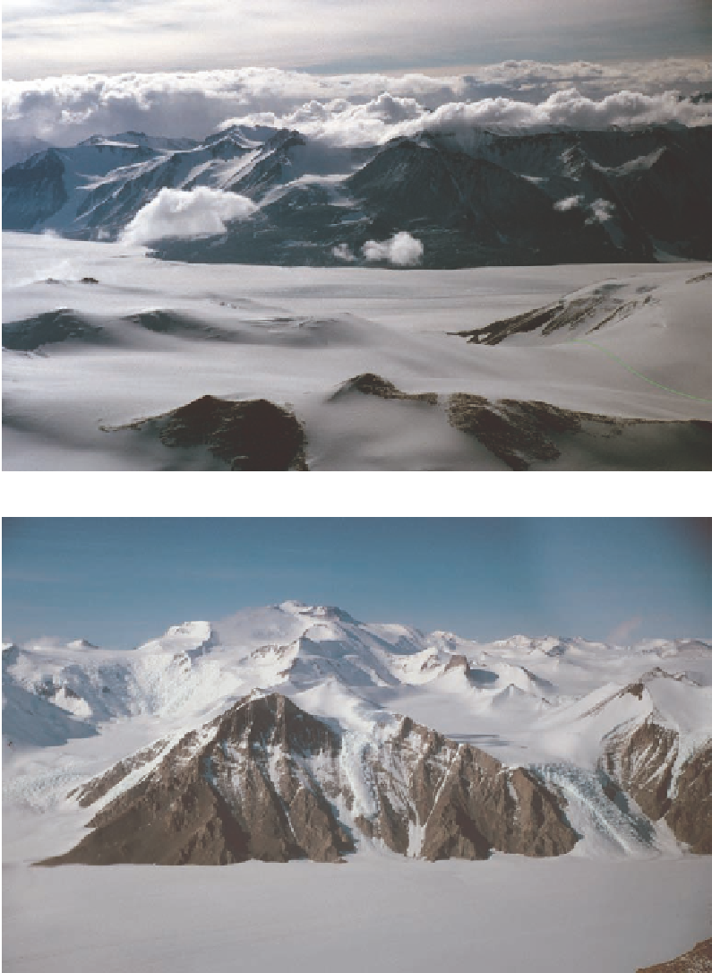
Figure 2.10. On December 7,
1902, Armitage, Koettlitz,
and Ferrar stood in the
pass in the lower right of
the image, looking down
onto Ferrar Glacier and
across to the corner of the
Kukri Hills. The descent
route looked so daunting
that Armitage chose to try
a route over the mountains
to the west. This proved to
be impossible (see Fig. 2.11),
so the party returned to
this spot and, following the
green route traced on the
image, lowered its sledges
down the steep incline to
Ferrar Glacier.
Figure 2.11. The eastern-
most buttress of the Cathe-
dral Rocks connects via the
ridgeline to the summit
of Mount Lister, at 12,209
feet the highest point in
the Royal Society Range.
The narrow platform at
the skyline at the left edge
of the image is the high-
est point that Armitage
reached, where he looked
down into the jumbled
icefall with its open cre-
vasses and upthrown
seracs. From there he
retreated to reconsider try-
ing Descent Glacier, about
a mile beyond the left
edge of the image. The left
(east) toe of the buttress
was the location of one of
Scott's depots during the
1903-1904 summer.
and then the support teams left for Winter Quarters Bay. Armitage now pinned his hopes
of reaching the interior on doing an end run of the Royal Society Range on the snowy
shoulder above the pass. This route wasted five days and a considerable amount of energy,
because the slope became so steep that it required block and tackle to pull up the sledges.
Beyond the crest of the shoulder Armitage had to confront a heavily crevassed and even
steeper glacier than he had seen from the lower pass (Fig. 2.11). Beyond this a network of