Geography Reference
In-Depth Information
37
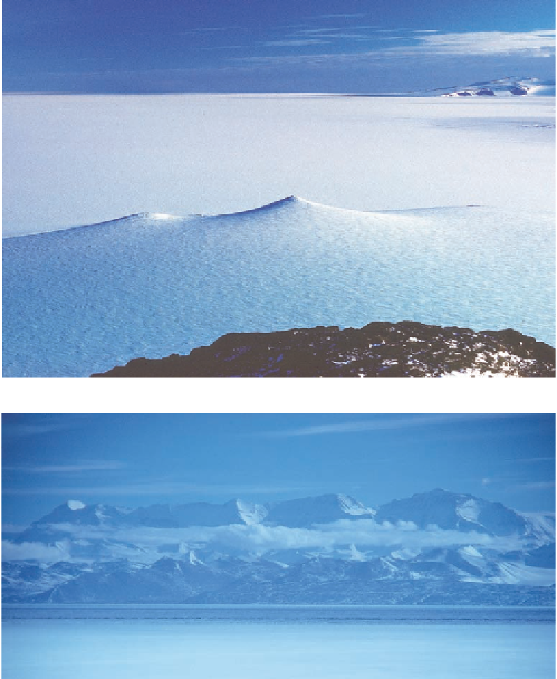
Figure 2.4. Level as the sea
upon which it floats, the
Ross Ice Shelf extends to
the horizon to the south of
Ross Island. White Island
appears at the right of the
image.
Figure 2.5. The twelve
thousand-foot wall of the
Royal Society Range looms
across McMurdo Sound,
with Mount Lister the sum-
mit at the right end of the
ridgeline. Hidden from
sight, Blue Glacier flows
from left to right (south to
north) behind the ice-free
foothills and in front of the
main range. Mount Hug-
gins, ascended from the
back side by Warren and
Brooke during the Inter-
national Geophysical Year
(see Chapter 7), is the high
peak to the left with the
faceted face in sun. This
image connects immedi-
ately to the left (south) of
Fig. 2.2.
McMurdo Sound. Perhaps in this lower country the explorers would find a breach, or a
portal, to the other side. North from there the mountains diminish in elevation and dis-
appear over the horizon.
Now turn around 180°. Behold Ross Island in all of its splendor (Fig. 2.6). The sum-
mit of Mount Erebus is belching steam that rises in great puVs, drifting lazily to the
north. The gentle incline below the summit drops oV in a steeper middle section, which
then fans out broadly at the base of the mountain. The peninsula you are standing on is
about twenty-five miles long and aims like a rifle toward the shoulder of Mount Erebus,
with Castle Rock, five miles oV, sticking up on the ridge like the sight on a barrel.
OV to the right of Erebus is its twin, Mount Terror. Conjoined at the shoulders,