Geography Reference
In-Depth Information
32
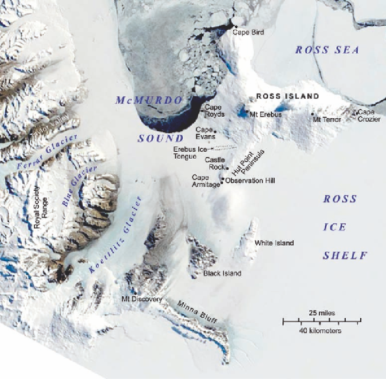
Figure 1.17. In this satellite
image of the McMurdo
Sound area, sea ice is fast
as far north as Cape Royds,
where Shackleton's winter
quarters were located in
1907-1909. In 1902 Scott
was able to penetrate as
far south as Hut Point,
whereas during his second
expedition he reached only
as far south as Cape Evans.
diYculty in eVecting a land communication with our post oYce at Cape Crozier.
There are no signs of pressure on the ice; on the other hand, the shelter from the
wind is but meager, and one can anticipate intense cold and howling gales. On the
whole to-night I feel like staying where we are.
The next day everyone set out to explore in diVerent directions. When they reassem-
bled that evening, there was great excitement detailing where each had been and argu-
ing about the lay of the land as seen from diVerent vantages. The two observations upon
which they generally agreed were that the Parry Mountains did not exist and that Mount
Erebus and Mount Terror formed an island, with the land that appeared to connect them
to the mainland in fact being two low islands named simply White Island and Black Is-
land (Fig.1.17).
Next the party set about to construct two small huts for geomagnetic observation
and a larger one for storage. This square wooden structure with its low, pyramidal roof
would also figure importantly in the later expeditions of Shackleton and of Scott, and
today it is still standing on the outskirts of McMurdo Station, infusing the spot with