Geography Reference
In-Depth Information
12
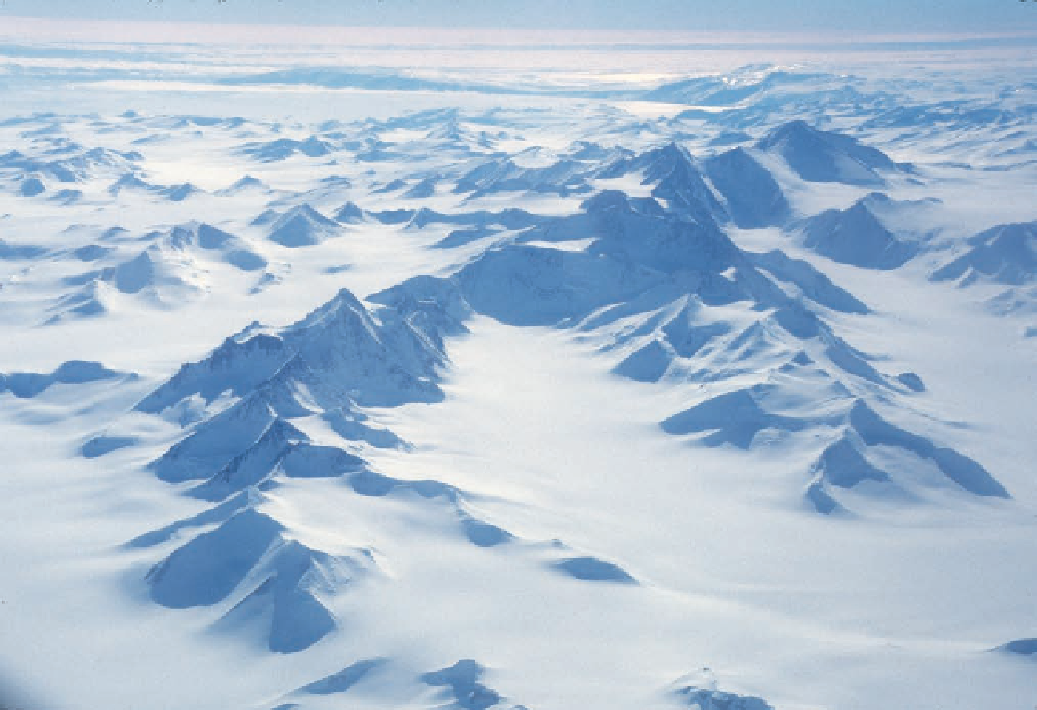
Figure 1.6. This aerial image of a portion of the Admiralty Mountains is viewed to the east in the
opposite direction from the sightings by Ross and later explorers. Mount Minto, the highest point
in northern Victoria Land, is the dark, faceted peak in the upper right of the image. Mount Adam is
the prominent peak a short distance to the left at the culmination of three ridgelines. The dark mas-
sif with the rounded summit directly in front of Mount Adam is Mount Royalist. The dramatic peak
halfway along the ridgeline to the left is Mount Black Prince. Mount Royalist and Mount Black Prince
were first sighted in 1958 by the New Zealand geological party working on Tucker Glacier (compare
Fig. 1.5). The Adare Peninsula is the dark cliff that subtly rises and falls on the far side of Robert-
son Bay in the rear of the image. This is the long, volcanic ridge noted by McCormick as the ships
approached the land. Robertson Bay was full of tight pack, which prevented their entering. Ridley
Beach, the site of Borchgrevink's winter-over, is at the northern (left) tip of the peninsula.
(Fig. 1.7). More often than not, the peaks would fade in and out of view as clouds over-
took them, and the ships would give more distance to the land. One high, conical peak
well to the south, glimpsed on several occasions, reminded the men of Mount Etna, the
famous volcano on the island of Sicily.
On January 22 the ships crossed 74° 15′ S, surpassing Weddell's record for southern-
most travel. Ross wrote, “An extra allowance of grog was issued to our very deserving