Geography Reference
In-Depth Information
217
iar landmarks of Taylor's naming—Gondola Ridge, Sperm BluV, Queer Mountain—as
they sledged up to the plateau (see Figs. 1.14, 3.15).
After an airborne resupply at the head of Mackay Glacier, the party turned north
and sledged all the way to Trinity Nunatak in the upper reaches of Mawson Glacier, thus
completing two parallel traverses to 76° 30′ S, one along the coast and the other along
the plateau (see Fig. 3.8). On December 15 the men were back at the depot at the head of
Mackay Glacier, where they pushed south, glimpsing several times into the upper Victo-
ria and Wright Valleys (Fig. 7.6). On December 26 they peered down the icefall where the
men of Scott's party had slipped and fallen on December 4, 1903, on the return from their
plateau traverse. From the head of Ferrar Glacier, Douglas and Warren flew back to Scott
Base on January 16. Gunn and Brooke turned their attention to the backside of Mount
Huggins, and relying on a bivouac partway up the mountain, put together a route to the
summit of the second-highest peak in the Royal Society Range (see Fig. 2.5). Alas, the
view on the far side was obscured by cloud. Following the descent they traversed down
Skelton Glacier to the depot left by Hillary. There they were picked up and flown back to
Scott Base on February 6, thus ending one of the most epic seasons in the annals of Ant-
arctic mapping.
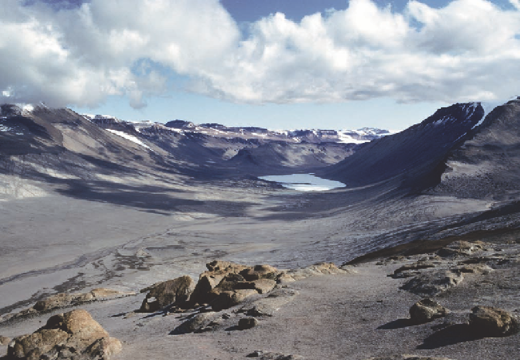
Figure 7.4. upper Wright
Valley, as viewed from
Bull Pass, displays a classic
u-shape, cut in the past
by a glacier flowing into it
from the East antarctic Ice
Sheet. This glacier has now
retreated to the west of
The Labyrinth at the very
head of the valley (see Figs.
2.9, 7.6). The white feature
in the bottom of the valley
is frozen Lake Vanda, fed
by meltwater of the onyx
River, flowing in on the left
side of the image.