Geography Reference
In-Depth Information
179
from its southernmost penetration. The men would travel light and, they hoped, far, but
whatever route was chosen they would be backtracking over it on the return.
The next morning as Blackburn recorded weather observations, he wrote in his log,
“All visible mountains stand out this A.M. in grandeur.” Across Scott Glacier the two
thousand-foot sheer wall of Taylor Ridge (see Figs. 6.2, 6.3), breached only by two small
icefalls, directed the glacier's flow for more than ten miles. Behind this arose a complex
of ridgelines and spurs that culminated at Mount GriYth, a ten thousand-foot peak and
the northernmost in a line of summits that crested the Hays Mountains (Fig. 6.4). To the
south they seemed to rise to even higher elevations, but the distances were too great to
be sure.
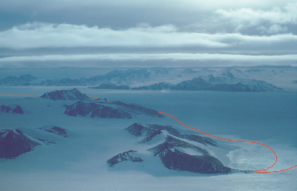
Figure 6.3. Durham Point splits the drainages of Scott and Leverett Glaciers in the lower right of the
image. At the start of their ascent of Scott Glacier, Blackburn's party camped about a half-mile from
this point, just outside the frame to the right. In the morning the party ran down the ice incline to
the point of rock and there built a prominent cairn “about 100 feet above level of barrier.” From
there the party sledged south along the eastern margin of the glacier, stopping to camp at the foot
of Mount Hamilton, the third massif to the rear with the faceted peak at its western end. Taylor
Ridge, the dark wall in the background, dikes the western bank of lower Scott Glacier. In the rear the
highest summits of the Hays Mountains are lost to stratus clouds suspended in the scene.