Geography Reference
In-Depth Information
100
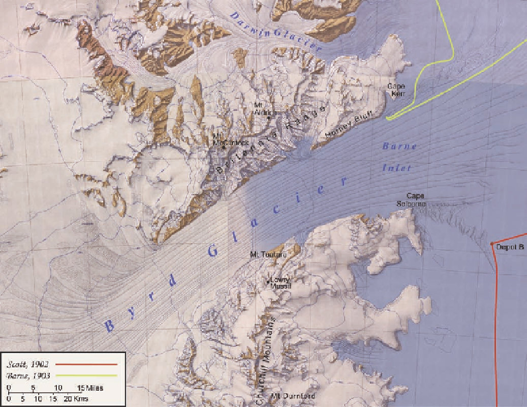
Figure 4.2. Shaded-relief map of the Byrd Glacier area. In early December 1902, as Scott's party
hauled toward the mountains, the ice shelf retreated back into an inlet that appeared to cut clean
through. On the north side of this inlet, sheer walls of the Britannia Range climbed to heights
greater than ten thousand feet. The party approached Cape Selborne, where it placed a depot for
the return. As the men hiked toward the rocky outcrop at the cape, they were stopped by a great
chasm in the ice shelf. Thereafter they traversed south along the mountain front. The following
year as Barne's party tried to approach rock on the north side of the inlet, it too was thwarted by
an immense chasm in the ice. It is now known that Byrd Glacier carries by far the largest volume of
ice of any of the outlet glaciers that cross the Transantarctic Mountains, and that these chasms are
where it rips into the Ross Ice Shelf on its way to the sea.
speculated (correctly) “form(s) the backbone of the whole continent.” The upper slopes
reaching to more than nine thousand feet were blocky, with snow-clad, horizontal layers,
similar to the Royal Society Range. A series of steep spurs dropped from the summits
that stood above the high ridgeline. The peak directly opposite the bay formed a perfect
pyramid, and so was named Pyramid Peak (Fig. 4.5). The highest portion of the range