Geography Reference
In-Depth Information
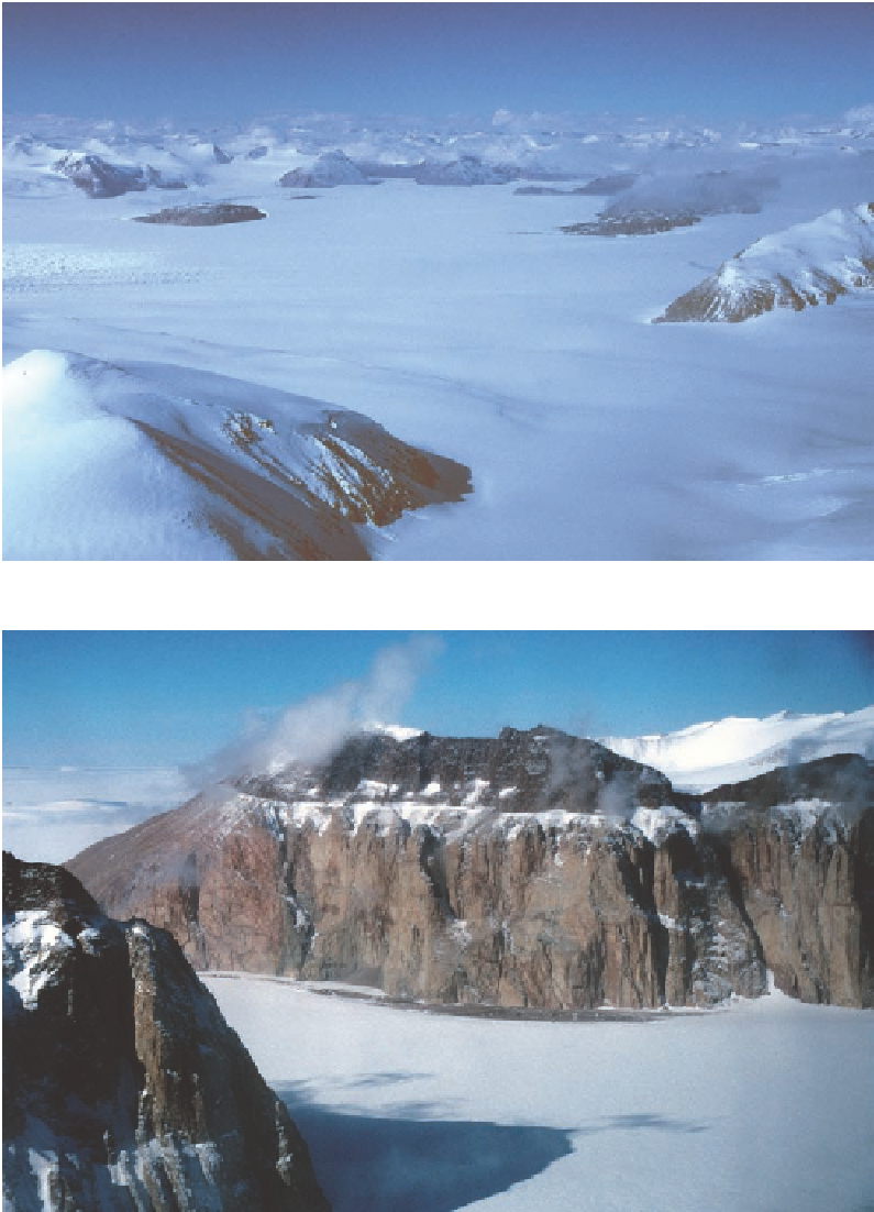
Figure 3.15. This panorama,
looking to the southwest,
encompasses the area
surveyed by Taylor's party
in 1911-1912 (compare Fig.
1.14). Following counter-
clockwise from the ridge
on the right margin, the
features include: (1) the
eastern end of the ridge
containing Referring
Peak; (2) Gondola Ridge
and Mount Suess almost
entirely obscured in cloud;
(3) Sperm Bluff, with its
left end reminiscent of a
sperm whale rising, a steep
profile on the left and
more gentle incline to the
right; (4) Queer Mountain,
the buttress to the left
and behind Sperm Bluff,
partially mantled in cloud;
(5) the southeastern end
of Killer Ridge, with its
snow-clad ridgeline that
extends to the left rear
(Fig. 3.16 looks back to this
ridge and Sperm Bluff from
the southwest); (6) Redcliff
Nunatak, the dark island
free of snow; (7) a name-
less buttress on the north
side of the Gonville and
Caius Range; and finally (8)
the ruffled pattern of cre-
vasses at the head of the
falls into Granite harbour
(approximately the right
edge of Fig. 3.14).
Figure 3.16. The southwest wall of Killer Ridge rises eight hundred feet up from Miller Glacier. The
lower heights are composed of granite, the upper reaches dolerite, intruded along an old erosion
surface on the granite. A shoulder of Queer Mountain holds the left foreground.