Global Positioning System Reference
In-Depth Information
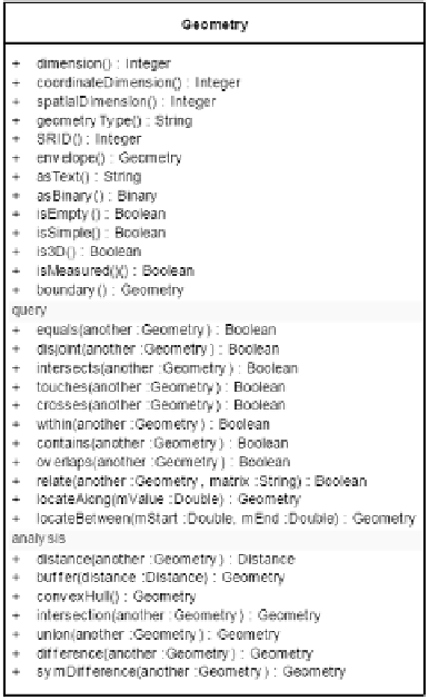
Fig. 1.
OGC geometry class.
v. Analysis and Metric Functions:
these functions enable to perform
some spatial analysis on the data, including:
• length(): returns the length of the geometry (linestring or
multilinestring);
• area(): returns the area of the geometry (polygon or multi-polygon);
• distance(theGeom): returns the distance between the geometries;
• buffer(distance): returns a geometry that represents all points whose
distance from this geometry is less than or equal to distance;
• convexHull(): returns the minimum convex geometry that encloses
all geometries within the set.
vi. Set functions:
these functions are used to perform set oriented
functions on spatial data, including:
• intersection(theGeom): returns a geometry that represents the
intersection of the geometries;
• union(theGeom): returns a geometry that represents the union of
the geometries;
Search WWH ::

Custom Search