Global Positioning System Reference
In-Depth Information
We created a routing algorithm from scratch that works effi ciently
running locally in a smartphone device and it is scalable until distances up
to 1 km. The algorithm uses a backtracking function with some heuristics
that improve effi ciency and reduce memory requirements, in order to work
on a smartphone device. For a deeper explanation see (Descamps-Vila et
al. 2012b).
Proof of Concept: Itiner@
This section presents the final product developed considering the
architecture presented in Section “Tests and Discussion”, which is an
Android application, called Itiner@.
Final Architecture
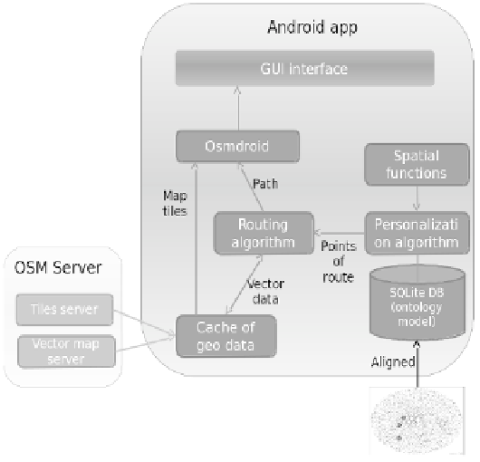
The fi nal architecture (see Fig. 9) combines GIS functionality with semantic
data stored in a relational database.
We developed a location-aware application that provides an all-in-
one system with the following features: 1) stores and manages spatial
data locally; 2) displays cartographic data and facilitates interaction with
Fig. 9.
Final architecture of the project.
Color image of this figure appears in the color plate section at the end of the topic.
Search WWH ::

Custom Search