Global Positioning System Reference
In-Depth Information
Table 9.
Example of GetFeatureInfo query.
Id
Address
urbainArea
urbanArea
percentUrban
interestPoints
TypeRest
Town
Rest
Economic
Touristic
if the source belongs to the required attributes and at least an attribute of the
destination does not belong to the required fi nal attributes in order to defi ne
attributes to be added to the fi nal schema. Within the same defi nition of a
theme (e.g., “Economic”) other links {“L6”, “L7”} will be traversed under
the same conditions for the source attributes. The process will be similar
to a GetFeatureInfo operation in the case of a closure from a given theme.
Let us mention that for the GetFeature operation, the schema contains
relevant attributes.
Implementation
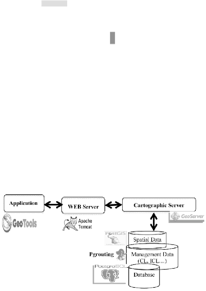
This proposition has been implemented with open source tools. Figure
10 sums up technical choices. They are compatible with norms and
open standards that allow interoperability between different systems
(applications, services and clients). PostgreSQL is used with its extensions:
PostGIS and PgRouting for graph manipulations. Geoserver is used as a
cartographical server since it provides raster and vector supports. Several
databases can be handled with this server.
Fig. 10.
Technical tools.


Search WWH ::

Custom Search