Geoscience Reference
In-Depth Information
since the early 1960s when a large-scale irrigation cam-
paign aimed at achieving independence in cotton produc-
tion was launched in Soviet Central Asia. This required
a massive expansion in irrigation in what is now Uzbek-
istan, Kazakhstan and Turkmenistan and so water was
diverted from the Aral's two feeder rivers, the Amu Darya
and the Syr Darya. Between 1960 and 1980 cotton pro-
duction doubled but by the 1990s river discharge into the
Aral Sea was reduced to such an extent that flow ceased
often for periods of 1-3 months. The volume of water
reaching the sea was reduced from 56 km
3
in 1960 to
3.5 km
3
in 1987 (Saiko and Zonn, 2000). The impact of
this on the Aral Sea was catastrophic. Between 1960 and
1995 there was a 17 m drop in level, a 753 km
3
reduction
in volume (
and cancers. The exposure of the former seabed and the
desiccation of surrounding soils has resulted in severe
dust storms, with an estimated 43-75 million tonnes of
sediment deflated annually in storms with plumes reach-
ing 4 km in height and travelling over 500 km downwind
(Micklin, 1988, 2007; Singer
et al.
, 2003; Wiggs
et al.
,
2003). This dust contains highly toxic material remnant
from the agricultural operations, including presticides, in-
secticides and fertilizers, that may have considerable im-
pacts on human health (O'Hara
et al.
, 2000; Bennion
et al.
, 2007). These storms are particularly severe with
strong north and north-west winds, which blow the dust
over the major population centres to the south.
Amelioration of the dust hazard emanating from the
Aral Sea basin will be extremely problematic over such
a large area where complex issues of water management
policy and conservation across national boundaries have
yet to materialise. Singer
et al.
(2003) suggest that, left
in their current state, the exposed soils of the southern
Aral Sea basin will continue to generate huge amounts of
dust. They suggest that the most efficient measure may
be to embark on a massive programme of conservation of
natural vegetation and suitable revegetation of susceptible
areas. In 2005 an $85 million World Bank project to build a
13 km long dyke to separate the Small from the Large Aral
was completed and this has led to the refilling of the Small
Aral (Micklin, 2007), which is now providing some inflow
into the Large Aral. However, as noted by Micklin (2007),
the only realistic means to increase flow substantially into
the Aral is by reducing upstream demand for water by
irrigation (which accounts for 92 % of withdrawals) to
provide an additional 54 km
3
70 %) and a 35 000 km
2
reduction in surface
∼
area (
52 %) (Saiko and Zonn, 2000). Furthermore, there
was a tripling of the salinity of the water in the Aral and a
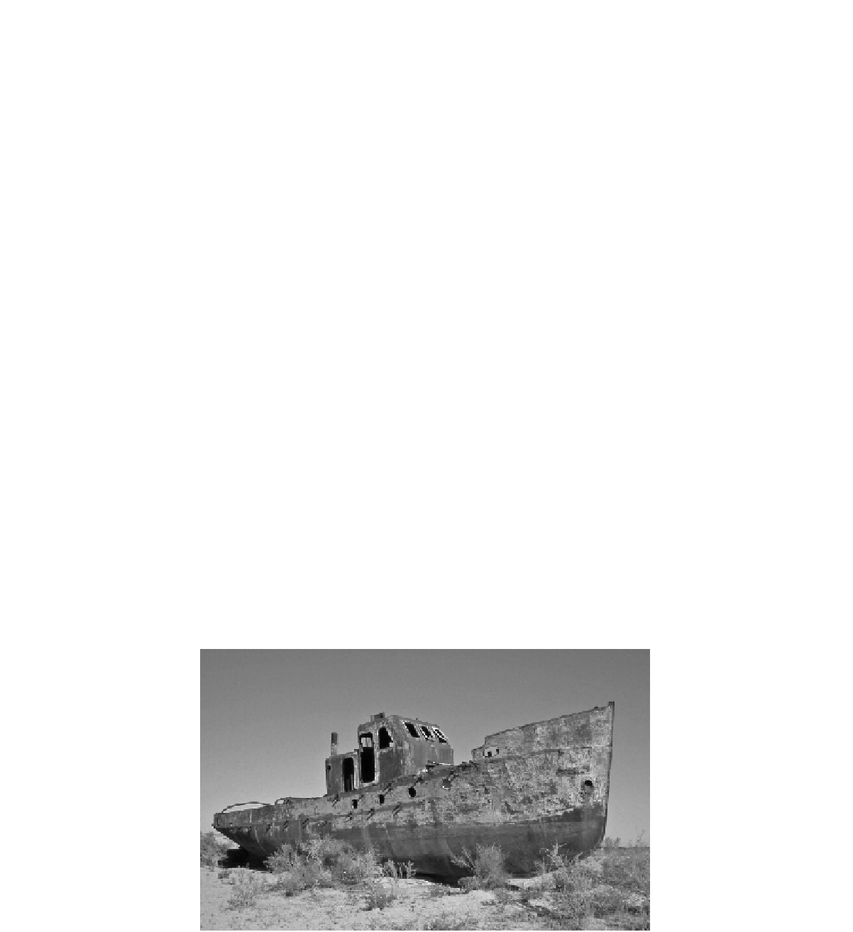
complete decimation of the fishing industry (Figure 23.7).
Between 1987 and 1989 the Aral separated into two seas
(the Small and Large Aral) and up to 2006 the area of
both seas had diminished by 74 % and the volume by
90 % since 1960 (Micklin, 2007).
The impact on the environment surrounding the Aral
Sea has been devastating. There is evidence of widespread
land degradation as the soil has become desiccated and
natural vegetation has died back, biodiversity has de-
creased, soils have become salinised and the climate of
the region has altered, with higher temperature extremes
and reduced precipitation (Kotlyakov, 1991). There is also
considerable evidence that the impacts of the catastrophe
are extremely detrimental to human health (Smith, 1991;
UNDP, 1997), with high levels of anaemia, lung disease
∼
of annual inflow. Efforts to